According to climate data, the mean temperature in November is of 17.6°C (a 20.6°C high and a 14.5°C low). Total precipitation in a typical November amounts to 93.6 mm. November is the third and final month of meteorological autumn, and as such is marked by continued gradual cooling down of air temperatures and episodes of showers which are often thundery and intense, depositing a large amount of rain in a short period of time. November is part of the typically wettest quarter of the year.
After careful study of long-term seasonal models, we’re expecting November 2021 to be overall around (or marginally warmer than) the norm. Long-term seasonal models currently suggest that a very warm start to the month should give way to temperatures which stabilize around the climatic norm. The sea remains warmer than average. This will maintain increased rates of evaporation from the sea. This is one of several ingredients required for copious rainfall from autumn storms. Another essential factor are incursions of cold air from the north. We’re expecting more of these to continue penetrating the central Mediterranean on occasion, meaning episodes of instability should not be lacking. We’re NOT expecting November 2021 to be drier than average. Whether or not it ends up being average or wetter than average depends on whether storm systems that form affect land or not. This is because one or two stormy episodes and one or two misses, may easily produce plentiful precipitation, pushing values to above or below average respectively.
FURTHER OUTLOOK (TEMPERATURE) FOR DEC-JAN-FEB 2021/2022 – Warmer than Average
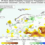
FURTHER OUTLOOK (PRECIPITATION) FOR DEC-JAN-FEB 2021/2022 – Average*
* An ‘Average’ outlook means that maps are pointing towards normal thunderstorm activity around the central Mediterranean. Whether or not a month ends up being drier or wetter than average will depend on whether any thunderstorms that form affect land or not. This is because one or two stormy episodes may easily produce plentiful precipitation, pushing values to above average. Conversely, one or two near misses may leave the Maltese Islands land area dry, pushing values to below average.
Disclaimer: Specific details on the weather may only be given for a couple of days in advance spójrz tutaj. This long-term forecast is not meant to determine specific weather parameters at a point on the Maltese Islands. Instead, it looks at large scale weather patterns across Europe, and attempts to determine how these may influence the weather locally. Our levels of confidence in the forecast for the month ahead are fair. These are reasonably lower when it comes to the ‘Further Outlook’ section. Weather forecasts are an interpretation of possible weather events based on trends, maps and climate data at the time of the forecast, and as a result, weather predictions may always change over time. Maltese Islands Weather can never be held responsible for any direct, indirect, incidental, consequential, special or exemplary damages or even lost profit resulting from any use or misuse of this data. The user assumes the entire risk related to the use or misuse of this data.


0 comments
Write a comment