According to climate data, the mean temperature in May is of 19.8°C (a 23.9°C high and a 15.7°C low). Total precipitation in a typical May amounts to 10.6 mm. May is normally characterized by the continued transition to summer. The weather is typically brighter and warmer. May is the third and final month of meteorological spring. Climatically, temperatures rise substantially over the course of the month. One would expect most days to be comfortable, although some evenings could still feel relatively fresh. Whilst spells of fine weather typically become longer and more frequent, they continue to be interrupted by the odd spell of grey skies, breezy winds and isolated light rain. The chance of rain normally dips in May. Precipitation in May is often unpredictable, however. In the majority of years, May marks the start of the summer drought. On the other hand, thunderstorms are not unheard of in May. This would occur due to the upper levels of the atmosphere still being relatively unstable. Sirocco winds are also quite common, and therefore, the threat of dusty rain and airborne fine desert sand from the Sahara extends into the first half of May. Long-term weather models are indicating that, with regards to temperature, May 2022 will likely end up being around or marginally below the average. The rise in temperatures will remain gradual, with the likelihood of any significantly warm or cold spells being relatively low. The same long-term weather models are suggesting that precipitation in May will be around or marginally below the average. This outlook is to be taken only as indicative. It indicates that storm systems across the central Mediterranean will be like in a typical year. One or two stormy episodes and one or two misses, may easily produce plentiful precipitation, pushing values to above or below average respectively. Whether or not it ends up being average or wetter than average depends on whether storm systems that form around us end up affecting land or not.
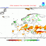
- Long-term seasonal model for precipitation for June/July/August 2022
- Long-term seasonal model for temperature for June/July/August 2022
FURTHER OUTLOOK (TEMPERATURE) FOR JUNE-JULY-AUGUST 2022 – Average
FURTHER OUTLOOK (PRECIPITATION) FOR JUNE-JULY-AUGUST 2022 – Average*
* An ‘Average’ outlook means that maps are pointing towards normal storm system activity around the central Mediterranean. As spring progresses, storm activity across the Mediterranean will naturally diminish. Whether or not a month ends up being wetter than average will depend on whether any anomalous rain-producing systems that form around the Maltese Islands affect land or not. This is because one localized stormy episode may easily produce plentiful precipitation, pushing values to above average.


0 comments
Write a comment