Long-Term Weather Outlook

Long-Term Weather Outlook

January 2021 Weather Outlook (and more)

According to climate data gathered over numerous years; the mean temperature in January is of 12.7°C (a 15.4°C high and a 9.9°C low), whilst the total precipitation in January is of 85.4 mm.

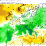
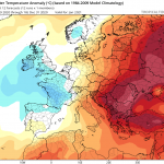
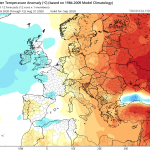
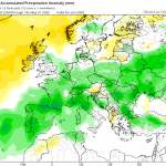
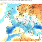
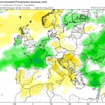
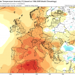
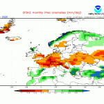
With regards to temperature, January 2021 is likely to follow the warmer than average trend set in December. No major cold snap, with nighttime lows well below 10°C, looks likely. As is to be expected as we reach the peak of winter, the second half of the month will be the cooler half. With regards to precipitation, it’s likely to follow in the steps of November and December. Over the past two months, total rainfall was lower than the mean, but it was not extremely low. We’re predicting rainfall to be approximately 25% less than the mean by the end of January. It will maintain another trend set in recent months. Whilst windy days will not be lacking, the low occurrence pf extremely strong winds will be noticeable.


FURTHER OUTLOOK (TEMPERATURE)

February 2021 – Warmer than Average

March 2021 – Average

April 2021 – Average


FURTHER OUTLOOK (PRECIPITATION)*

February 2021 – Average

March 2021 – Average

April 2021 – Wetter than Average


Disclaimer: Specific details on the weather may only be given for a couple of days in advance brasil-libido.com. This long-term forecast is not meant to determine specific weather parameters at a point on the Maltese Islands. Instead, it looks at large scale weather patterns across Europe, and attempts to determine how these may influence the weather locally. Our levels of confidence in the forecast for the month ahead are fair. These are reasonably lower when it comes to the ‘Further Outlook’ section. Weather forecasts are an interpretation of possible weather events based on trends, maps and climate data at the time of the forecast, and as a result, predictions may always change over time. Maltese Islands Weather can never be held responsible for any direct, indirect, incidental, consequential, special or exemplary damages or even lost profit resulting from any use or misuse of this data. The user assumes the entire risk related to the use or misuse of this data.

Long-Term Weather Outlook

December 2020 Weather Outlook (and more)

According to climate data gathered over numerous years; the mean temperature in December is of 14.3°C (a 16.9°C high and an 11.7°C low). According to climate data gathered over numerous years; total precipitation in December is of 97.1 mm.

With regards to temperature, the deviation from the mean in December 2020 is likely to be only marginal. Nights will likely be warmer than average, however. As is common in most years, a brief spell of cold temperatures could occur around Christmas or New Year’s. With regards to precipitation, December 2020 should be around average or slightly drier. It appears that the first half of the month should be wetter than the second half. No severe rainfall events are anticipated though. With regards to the incidence of gale-force winds, they are likely to be lacking in December 2020 as well.


FURTHER OUTLOOK (TEMPERATURE)

January 2021 – Warmer than Average (+0.25°C to 0.75°C)

February 2021 – Warmer than Average (+0.25°C to 0.75°C)

March 2021 – Average (+/- 0.25°C)


FURTHER OUTLOOK (PRECIPITATION)*

January 2021 – Drier than Average

February 2021 – Average

March 2021 – Average


Disclaimer: Specific details on the weather may only be given for a couple of days in advance. This long-term forecast is not meant to determine specific weather parameters at a point on the Maltese Islands. Instead, it looks at large scale weather patterns across Europe, and attempts to determine how these may influence the weather locally. Our levels of confidence in the forecast for the month ahead are fair. These are reasonably lower when it comes to the ‘Further Outlook’ section. Weather forecasts are an interpretation of possible weather events based on trends, maps and climate data at the time of the forecast, and as a result, predictions may always change over time. Maltese Islands Weather can never be held responsible for any direct, indirect, incidental, consequential, special or exemplary damages or even lost profit resulting from any use or misuse of this data. The user assumes the entire risk related to the use or misuse of this data.

Long-Term Weather Outlook

November 2020 Weather Outlook (and more)

According to climate data gathered over numerous years; the mean temperature in November is of 17.7°C (a 20.5°C high and a 14.8°C low). According to climate data gathered over numerous years; total precipitation in November is of 90.1 mm.

With regards to temperature, the deviation from the mean in November 2020 is likely to be only marginal. Nights will likely be warmer than average, however. With regards to precipitation, November 2020 is expected to continue the trend set in October and be drier than average (possibly significantly). The few rainfall events we’ll have will be separated by long spells of finer weather. Once again, the total rainfall we’ll receive will depend largely on whether the few rainfall events that form affect land or not.


FURTHER OUTLOOK (TEMPERATURE)

December 2020 – Average (-0.25°C to +0.25°C)

January 2021 – Warmer than Average (+0.25°C to 0.75°C)

February 2021 – Warmer than Average (+0.25°C to 0.75°C)


FURTHER OUTLOOK (PRECIPITATION)*

December 2020 – Drier than Average

January 2021 – Drier than Average

February 2021 – Drier than Average

* A ‘Drier than Average’ outlook means that maps are pointing towards lower than normal storm around the central Mediterranean, meaning fewer than usual rainfall events separated by long spells of finer weather. You could have a month with total rainfall higher than normal, but with much of the total rainfall falling in one or two heavy rainfall events. Whether or not a month ends up being significantly or marginally drier than average will depend entirely on whether any weather systems that form affect land or not.

Disclaimer: Specific details on the weather may only be given for a couple of days in advance. This long-term forecast is not meant to determine specific weather parameters at a point on the Maltese Islands. Instead, it looks at large scale weather patterns across Europe, and attempts to determine how these may influence the weather locally. Our levels of confidence in the forecast for the month ahead are fair. These are reasonably lower when it comes to the ‘Further Outlook’ section. Weather forecasts are an interpretation of possible weather events based on trends, maps and climate data at the time of the forecast, and as a result, predictions may always change over time. Maltese Islands Weather can never be held responsible for any direct, indirect, incidental, consequential, special or exemplary damages or even lost profit resulting from any use or misuse of this data. The user assumes the entire risk related to the use or misuse of this data.

Long-Term Weather Outlook

October 2020 Weather Outlook (and more)

According to climate data gathered over numerous years; the mean temperature in October is of 21.4°C (a 24.5°C high and a 18.2°C low). According to climate data gathered over numerous years; total precipitation in October is of 89.0 mm.

With regards to temperature, October 2020 is likely to be warmer than average, particularly at night. Despite this, the difference from the mean is not likely to be very wide. With regards to precipitation, October 2020 is expected to be drier than average. The few rainfall events we’ll have will be separated by long spells of finer weather. The total rainfall we’ll be receiving also depends largely on whether the few rainfall events that form affect land or not. September 2020 was a very clear example of this brasil-libido.com. When compared with the climate average, it was much wetter than normal. When you dig into the numbers, you’ll see that much of the rain fell in one or two heavy rainfall events halfway through the month.


FURTHER OUTLOOK (TEMPERATURE)

November 2020 – Warmer than Average (+0.25°C to 0.75°C)

December 2020 – Warmer than Average (+0.25°C to 0.75°C)

January 2021 – Warmer than Average (+0.25°C to 0.75°C)


FURTHER OUTLOOK (PRECIPITATION)*

November 2020 – Drier than Average

December 2020 – Average

January 2021 – Drier than Average

* A ‘Drier than Average’ outlook means that maps are pointing towards lower than normal storm around the central Mediterranean, meaning fewer than usual rainfall events separated by long spells of finer weather. You could have a month with total rainfall higher than normal, but with much of the total rainfall falling in one or two heavy rainfall events. Whether or not a month ends up being significantly or marginally drier than average will depend entirely on whether any thunderstorms that form affect land or not.

Long-Term Weather Outlook

September 2020 Weather Outlook (and more)

According to climate data gathered over numerous years; the mean temperature in September is of 24.6°C (a 28.1°C high and a 21.1°C low). According to climate data gathered over numerous years; total precipitation in September is of 49.9 mm.

With regards to temperature, September 2020 is likely to be hotter than average. It is likely that the difference from the mean will be significant (0.75°C to 1.5°C). Despite this, no extreme heat spells are anticipated. The sea surface temperature will remain very warm. This, coupled with the southerly winds that normally characterise most days in September, will make for higher levels of relative humidity. This will make some days feel much hotter than they actually are. With regards to precipitation, September 2020 is expected to be drier than average. Maps indicate that thunderstorm activity around the central Mediterranean will have a tendency to be quieter than normal. High pressure above the Maltese Islands may cause most thunderstorms to weaken before reaching us polska-ed.com. Whether or not it ends up being significantly or marginally drier than average will depend on whether any thunderstorms that form affect land or not. Thunderstorms in September vary from extremely localised (affecting just one or two localities) to widespread (affecting the whole nation).


FURTHER OUTLOOK (TEMPERATURE)

October 2020 – Warmer than Average (+0.25°C to 0.75°C)

November 2020 – Warmer than Average (+0.25°C to 0.75°C)

December 2020 – Around Average (-0.25°C to +0.25°C)


FURTHER OUTLOOK (PRECIPITATION)*

October 2020 – Drier than Average

November 2020 – Drier than Average

December 2020 – Average

* A ‘Drier than Average’ outlook means that maps are pointing towards lower than normal thunderstorm activity around the central Mediterranean. Whether or not a month ends up being significantly or marginally drier than average will depend on whether any thunderstorms that form affect land or not.

Long-Term Weather Outlook

August 2020 Weather Outlook (and more)

According to climate data gathered over numerous years; the mean temperature in August is of 27.0°C (a 31.1°C high and a 22.9°C low). According to climate data gathered over numerous years; total precipitation in August amounts to 7.9 mm.

With regards to temperature, August 2020 is likely to be hotter than average on the whole. Chances are that we will experience one or two heat spells. Levels of relative humidity will be significantly higher, making for much higher real feel values on hot days. Despite this, extreme heat waves are unlikely. Where precipitation is concerned, August 2020 is likely to be around average. This could mean a completely dry month, or at most, one day of rain. If we do experience a day of rain, this will likely be towards the end of the month.


FURTHER OUTLOOK (TEMPERATURE)

September 2020 – Around Average (-0.25°C to +0.25°C)

October 2020 – Around Average (-0.25°C to +0.25°C)

November 2020 – Around Average (-0.25°C to +0.25°C)


FURTHER OUTLOOK (PRECIPITATION)

September 2020 – Drier than Average

October 2020 – Drier than Average

November 2020 – Drier than Average

Long-Term Weather Outlook

July 2020 Weather Outlook (and more)

According to climate data gathered over numerous years; the mean temperature in July is of 27.0°C (a 31.2°C high and a 22.2°C low). According to climate data gathered over numerous years; the total precipitation in May amounts to 0.3 mm.

With regards to temperature, July 2020 should be around average on the whole ed-hrvatski.com. The only exceptions should be the first few days and the last few days of the month, when hotter than average temperatures are possible. Despite this, extreme heat waves are unlikely. Overall, precipitation in July 2020 should be around average. This could mean a completely dry month. If at all, only a day or two with partly to variably cloudy skies and a little drizzle is possible over the course of this month.


FURTHER OUTLOOK (TEMPERATURE)

August 2020 – Around Average (-0.25°C to +0.25°C)

September 2020 – Warmer than Average (+0.25°C to 0.5°C)

October 2020 – Warmer than Average (+0.25°C to 0.5°C)


FURTHER OUTLOOK (PRECIPITATION)

August 2020 – Average

September 2020 – Drier than Average

October 2020 – Drier than Average

Long-Term Weather Outlook

June 2020 Weather Outlook (and more)

According to climate data gathered over numerous years; the mean temperature in June is of 23.6°C (a 27.8°C high and a 19.4°C low). According to climate data gathered over numerous years; the total precipitation in May amounts to 3.9 mm.

With regards to temperature, June 2020 should be around average on the whole ed-hrvatski.com. Nights could prove to be warmer than the norm, however. No spells of excessive heat are anticipated. The first three weeks of the month are likely to see seasonal temperatures. Values should rise to above 30°C in the final week. The first half of June 2020 will likely be very unstable across the Mediterranean region. This will make its presence felt over the Maltese Islands too, with more mainly sunny or partly cloudy days and less days with uninterrupted bright sunshine. A day or two of isolated showers are also possible. The second half of the month will be far more settled. Overall, precipitation in June 2020 should be around average.


FURTHER OUTLOOK (TEMPERATURE)

July 2020 – Warmer than Average (+0.25°C to 0.5°C)

August 2020 – Warmer than Average (+0.25°C to 0.5°C)

September 2020 – Warmer than Average (+0.25°C to 0.5°C)


FURTHER OUTLOOK (PRECIPITATION)

July 2020 – Average

August 2020 – Average

September 2020 – Drier than Average

Long-Term Weather Outlook

May 2020 Weather Outlook (and more)

According to climate data gathered over numerous years; the mean temperature in May is of 19.6°C (a 23.4°C high and a 15.8°C low). According to climate data gathered over numerous years; total precipitation in May amounts to 9.9 mm.

With regards to temperature, May 2020 should be significantly warmer than average. At least one heat spell could occur over the course of this month. This will likely occur in the first half of the month. May 2020 will probably be drier than average too. The first half of the month will almost certainly be completely dry. Whilst a little rain could occur over the course of the second half of May, certain maps still insist the possibility of a completely dry May for the Maltese Islands. Severe weather is highly unlikely.


FURTHER OUTLOOK (TEMPERATURE)

June 2020 – Average (-0.25°C to +0.25°C)

July 2020 – Warmer than Average (+0.25°C to 0.5°C)

August 2020 – Warmer than Average (+0.25°C to 0.5°C)


FURTHER OUTLOOK (PRECIPITATION)

June 2020 – Average

July 2020 – Average

August 2020 – Average

Long-Term Weather Outlook

April 2020 Weather Outlook (and more)

According to climate data gathered over numerous years; the mean temperature in April is of 16.1°C (a 19.4°C high and a 12.8°C low). According to climate data gathered over numerous years; total precipitation in April amounts to 20.9 mm.

With regards to temperature, April 2020 should be close to average. The first week of the month may be slightly cooler than average, however. Temperature will rise to around average from the second week, although a short spell of cooler than average temperatures cannot be ruled out. Heatspells are unlikely. Precipitation in April 2020 should be around average as well. Rain will come in isolated showers. Spells of instability will grow shorter and become less frequent. Spells of fine weather, on the other hand, will now grow longer and become more frequent. Severe weather is not likely.


FURTHER OUTLOOK (TEMPERATURE)

May 2020 – Warmer than Average (+0.5°C to 1.0°C)

June 2020 – Warmer than Average (+0.5°C to 1.0°C)

July 2020 – Warmer than Average (+0.75°C to 1.25°C)


FURTHER OUTLOOK (PRECIPITATION)

May 2020 – Average

June 2020 – Average

July 2020 – Average