Reports

Reports

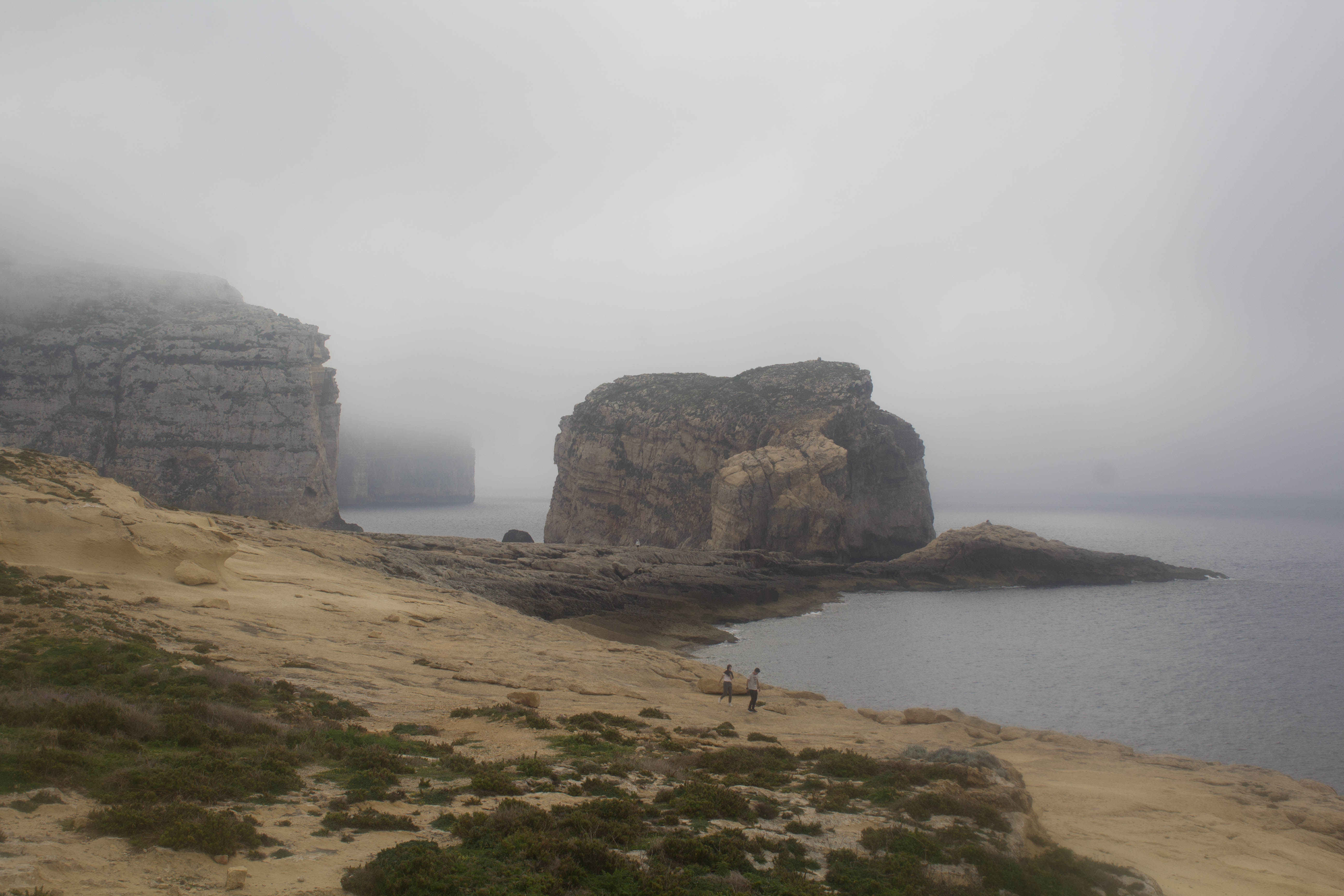
Weekly Outlook (18/03/2019 to 24/03/2019)

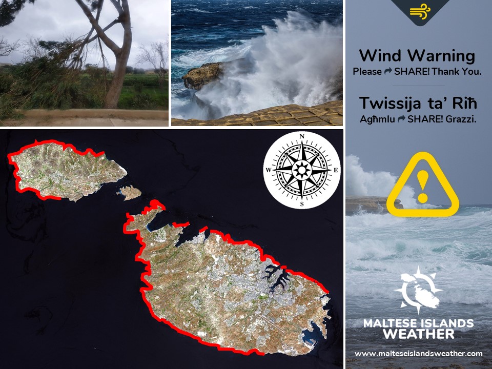
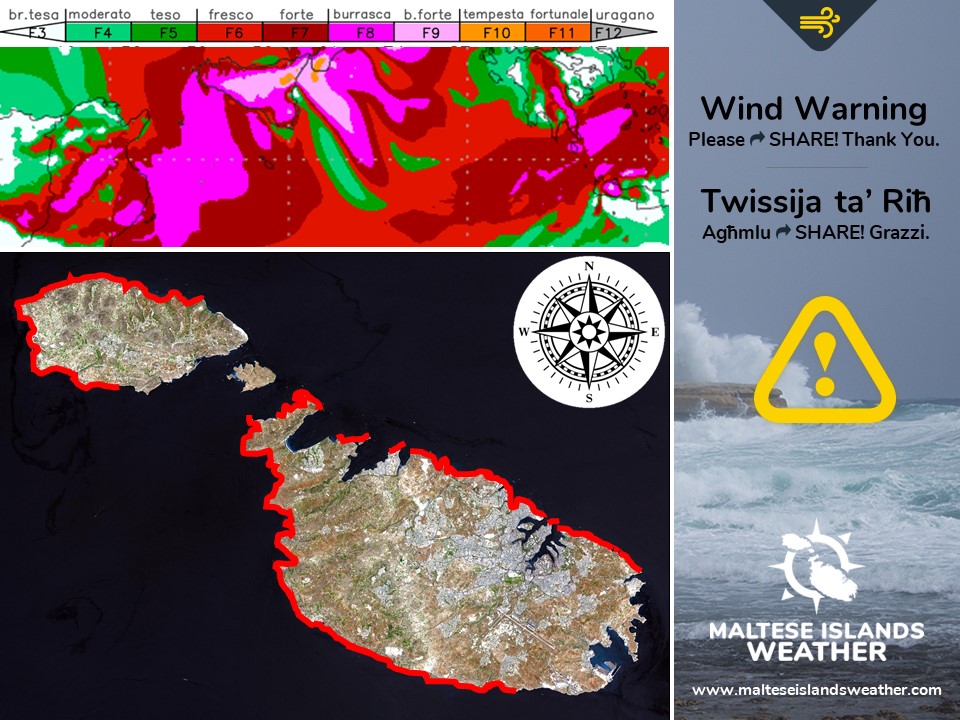
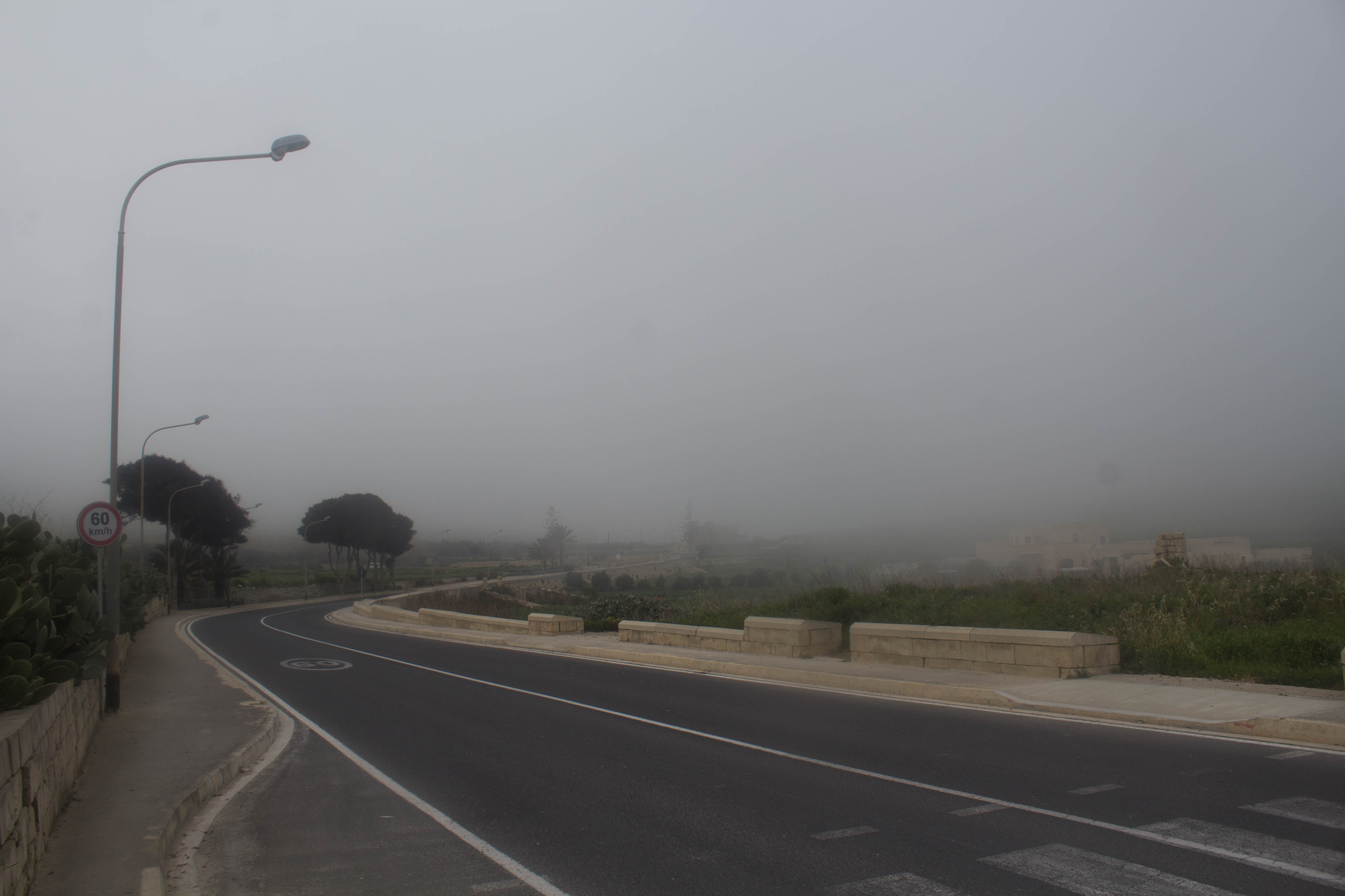
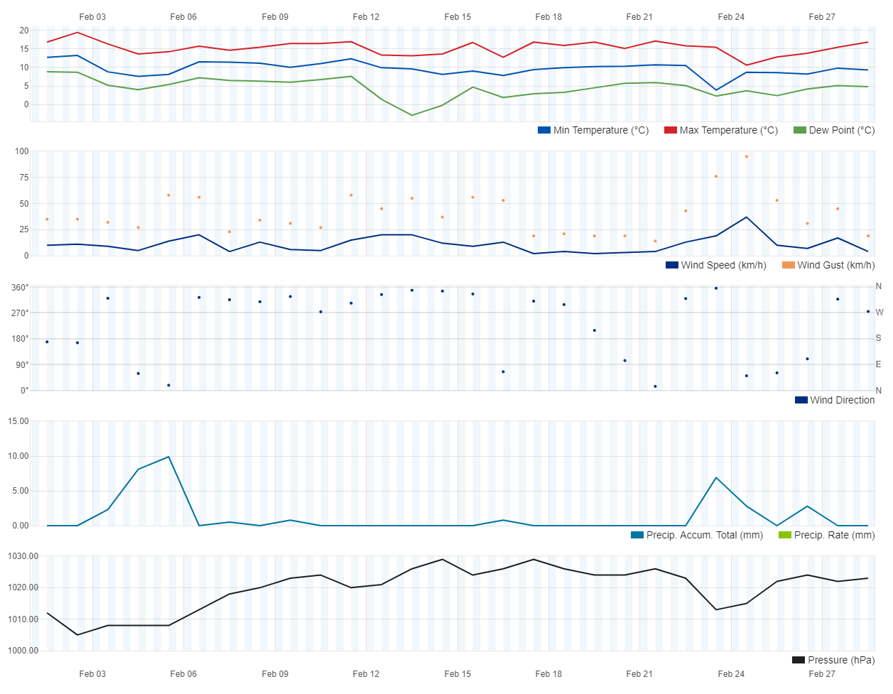
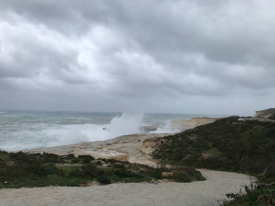
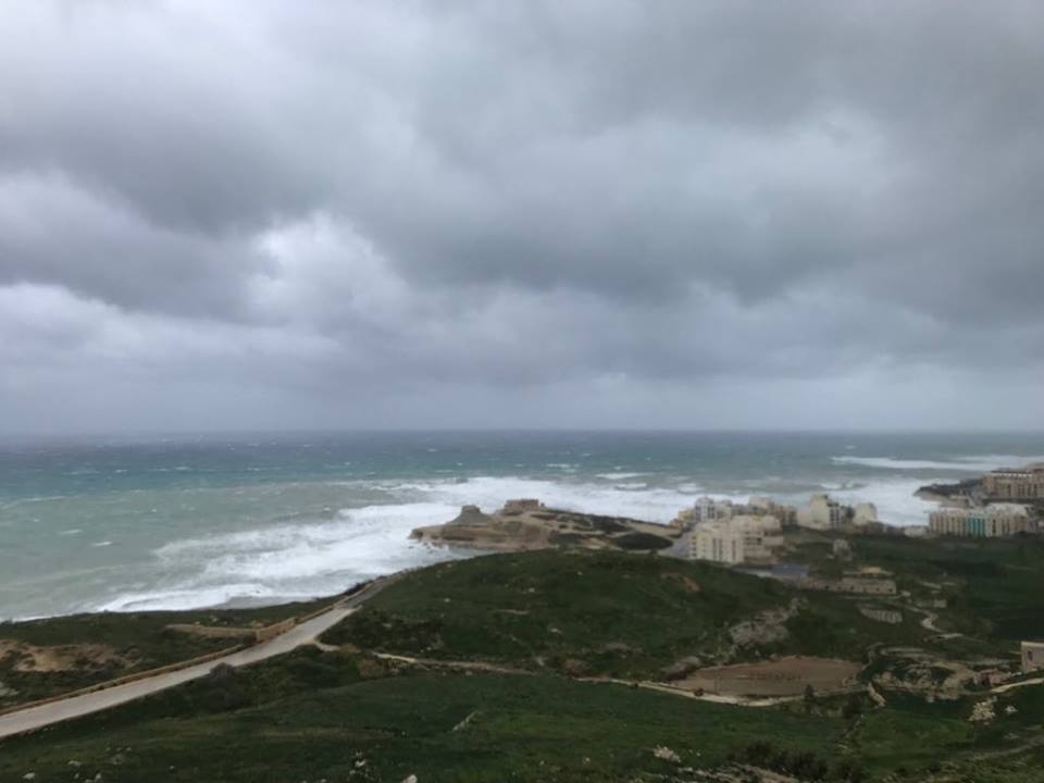
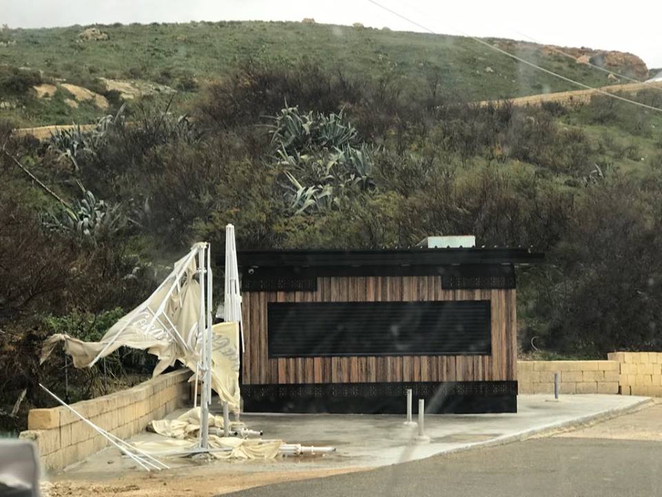
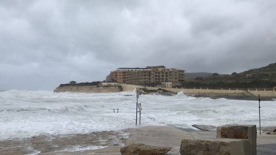
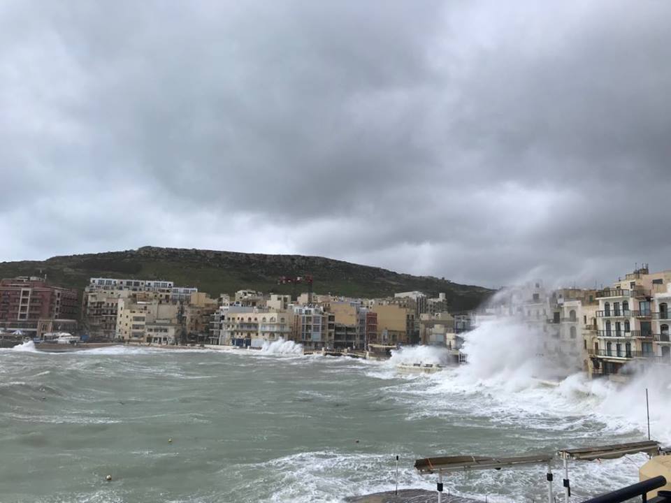
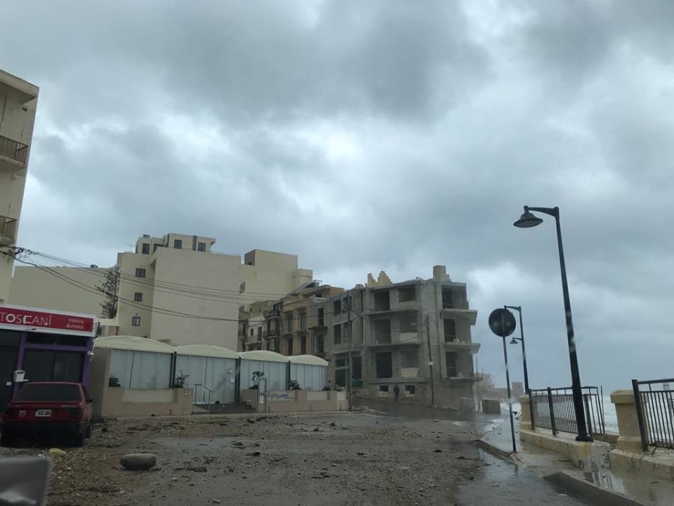
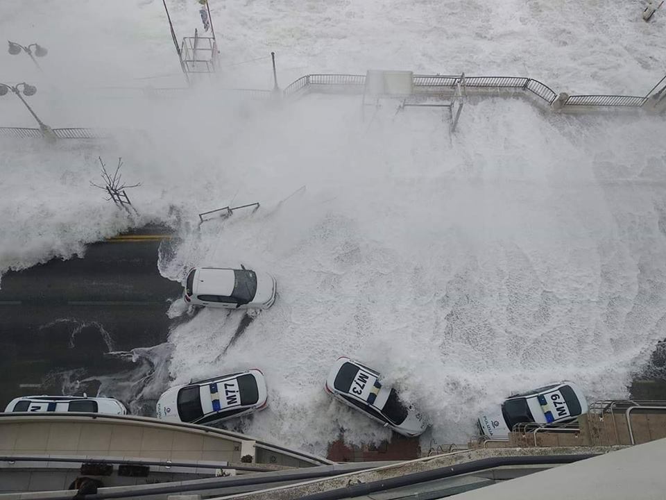
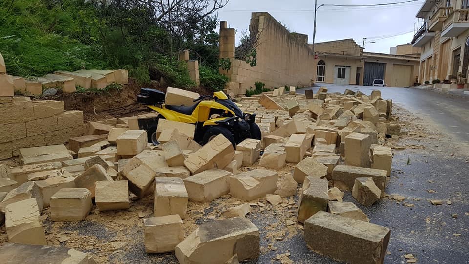
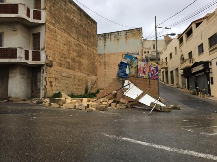
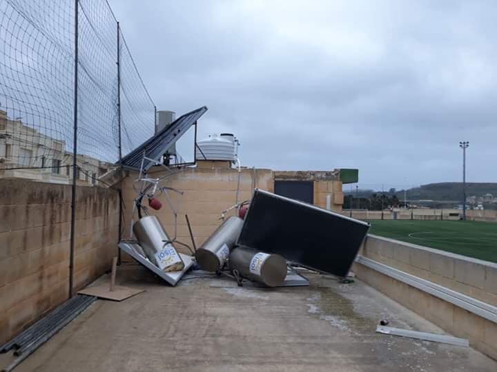
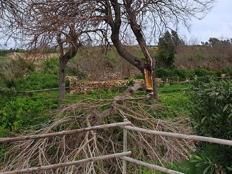
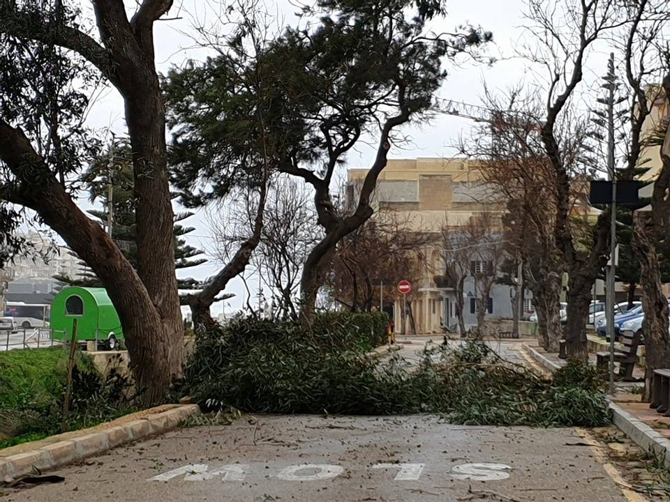
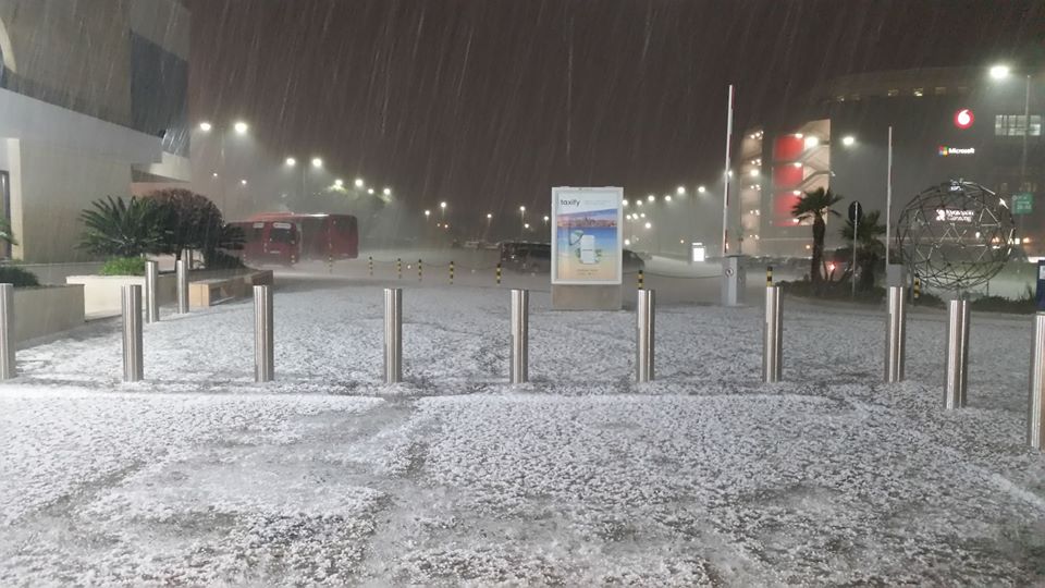
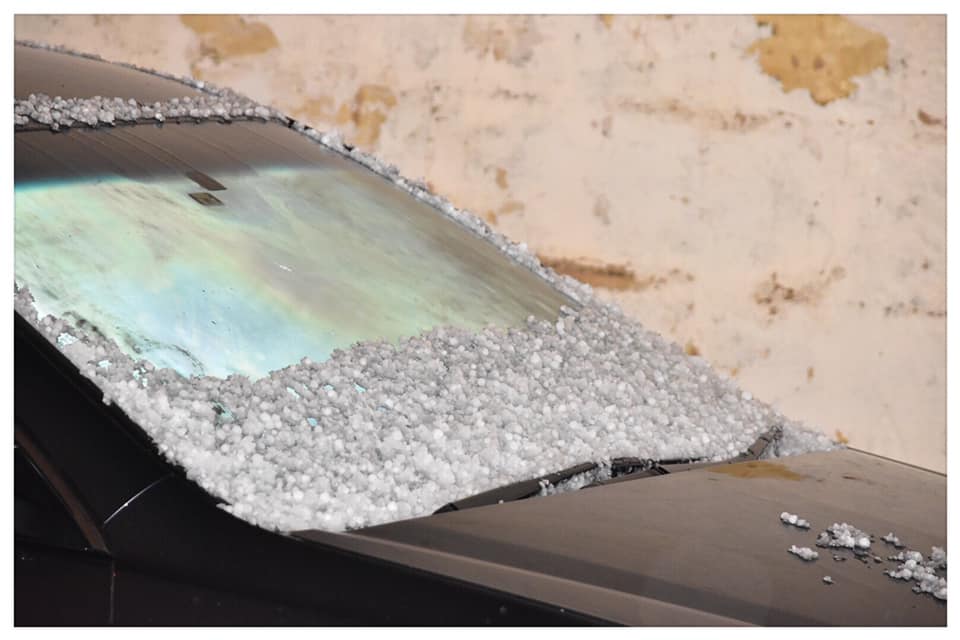
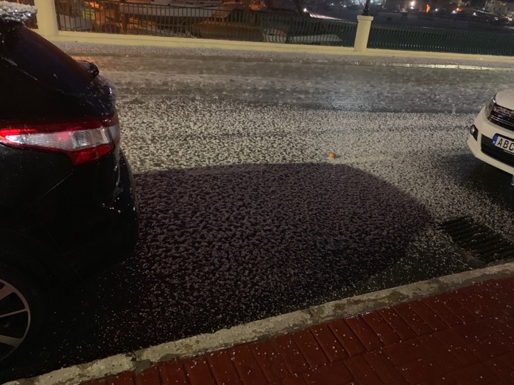
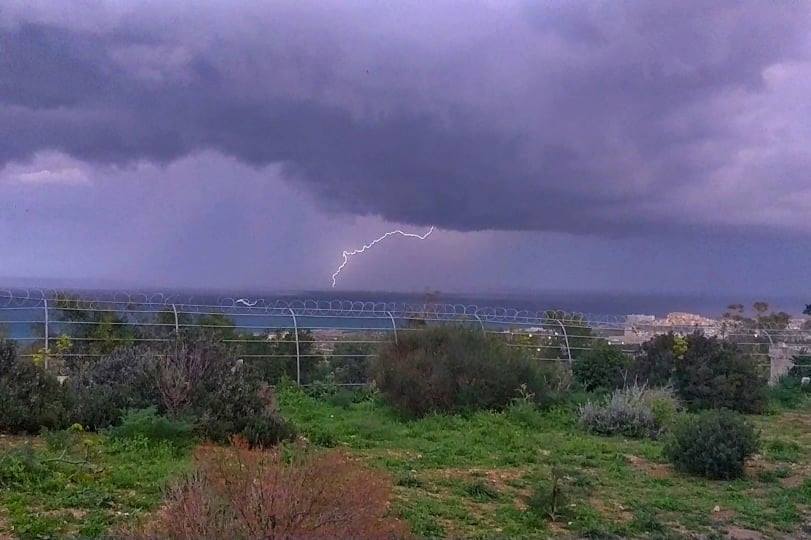
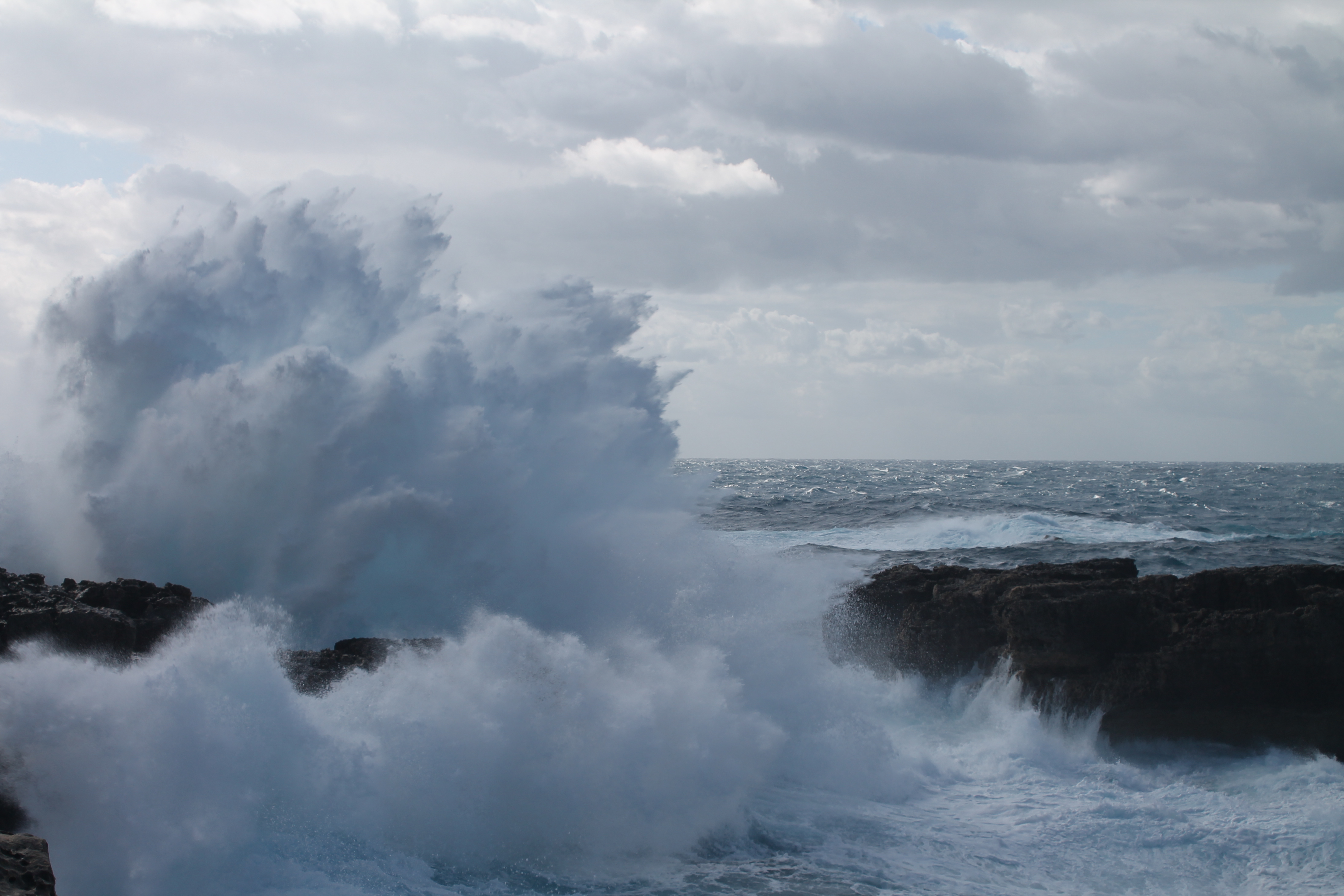
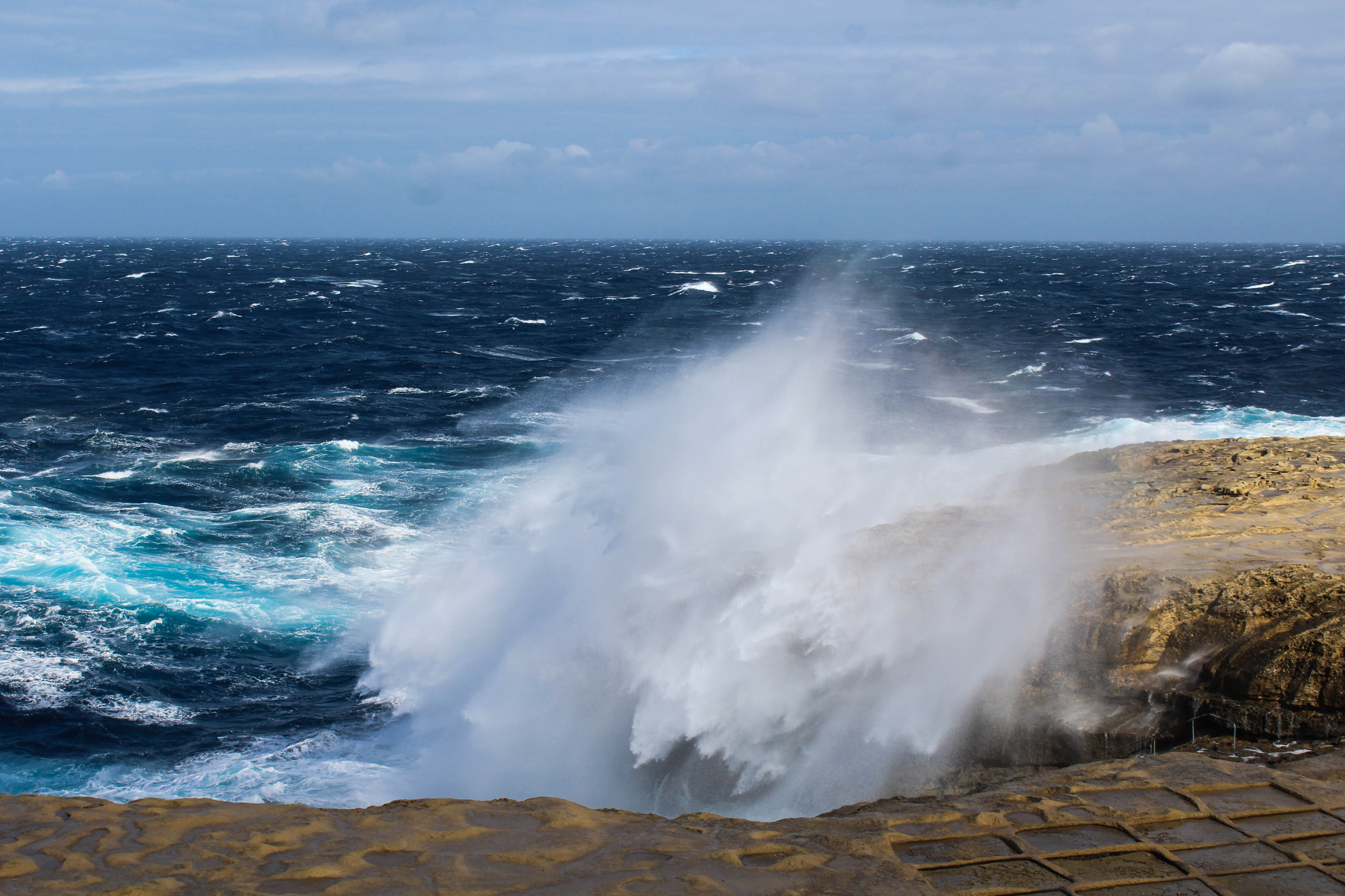
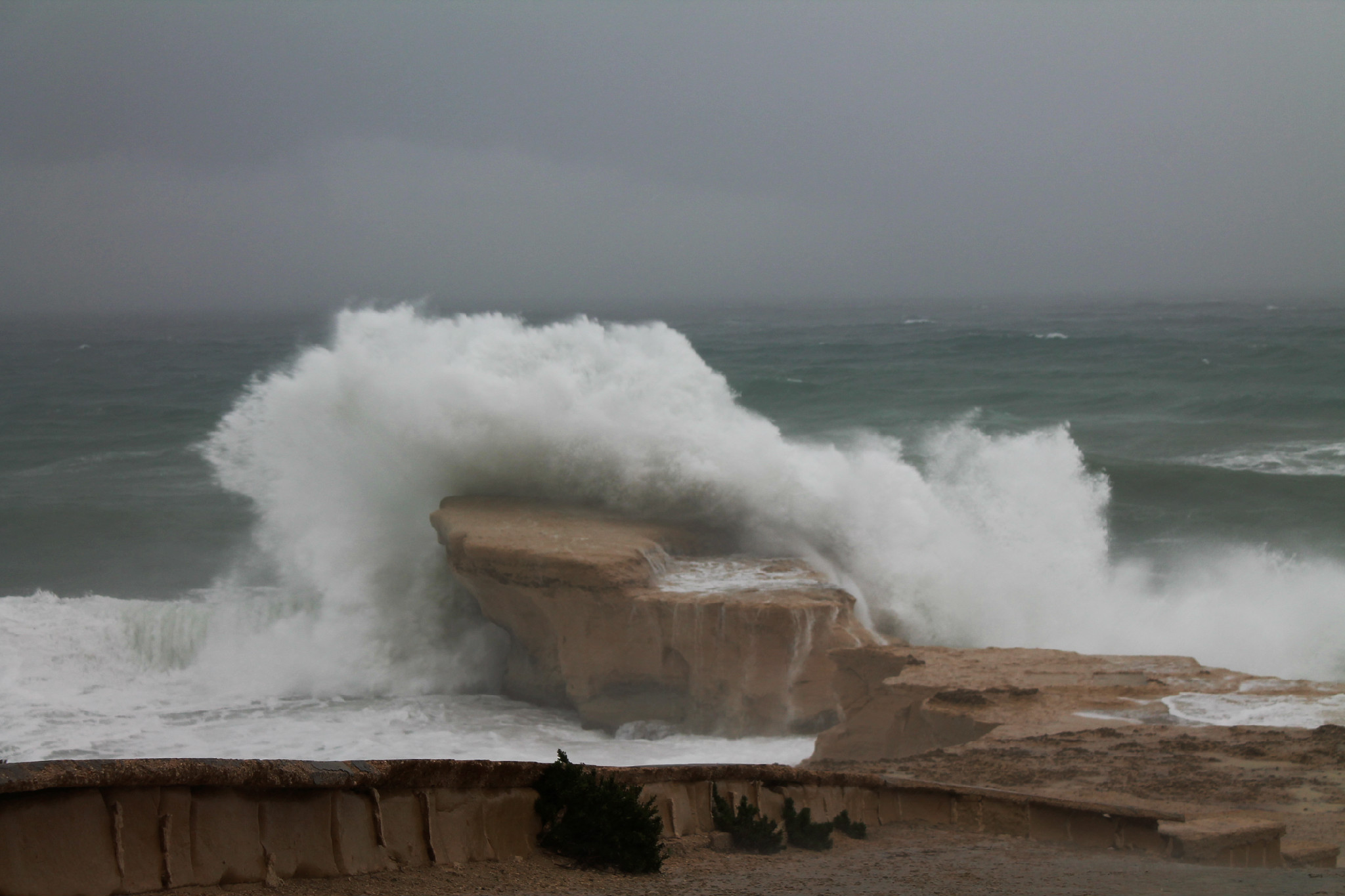
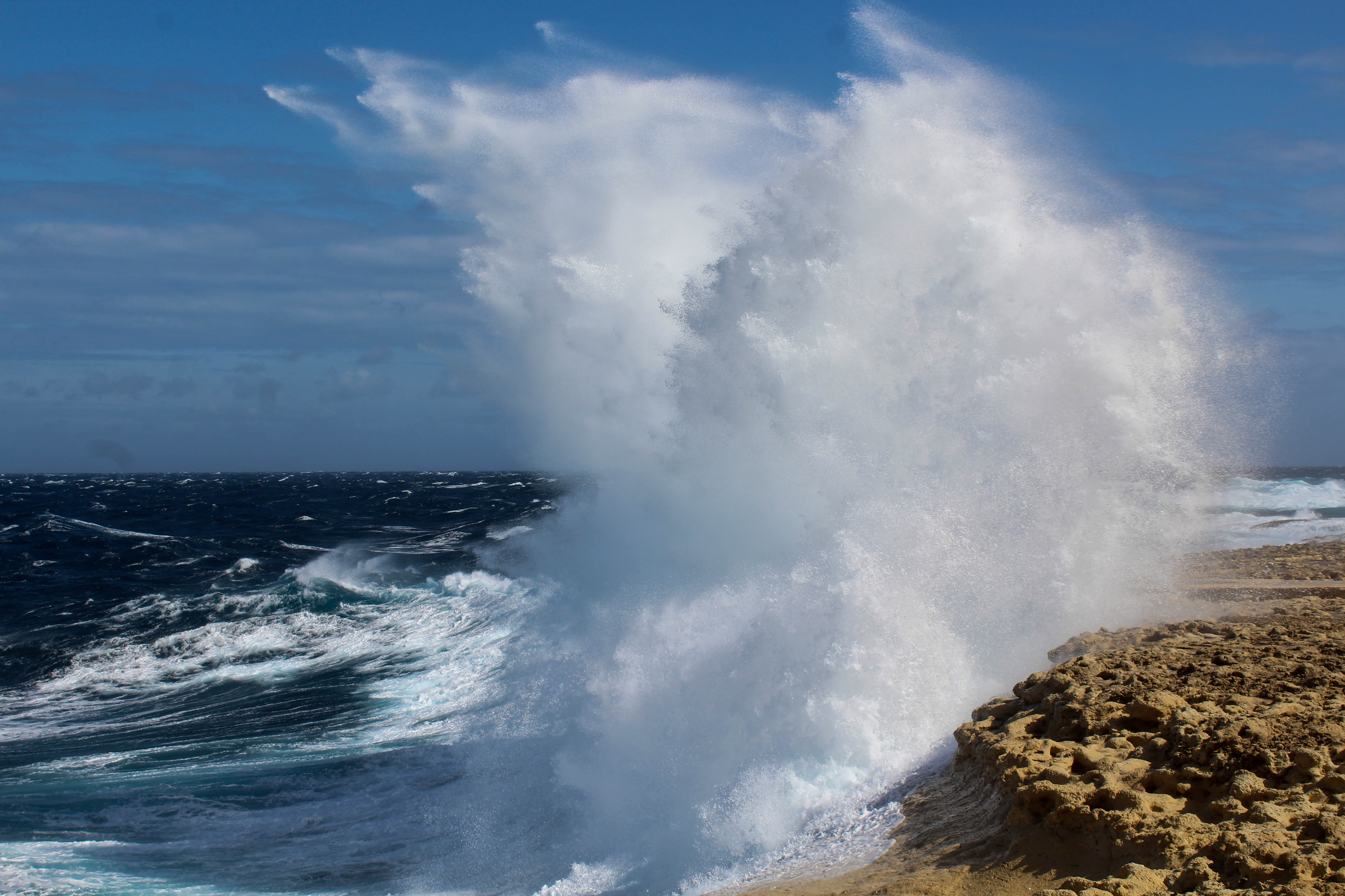
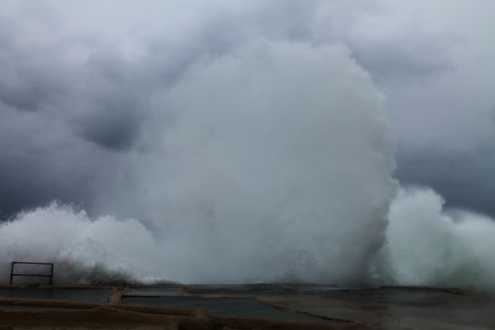
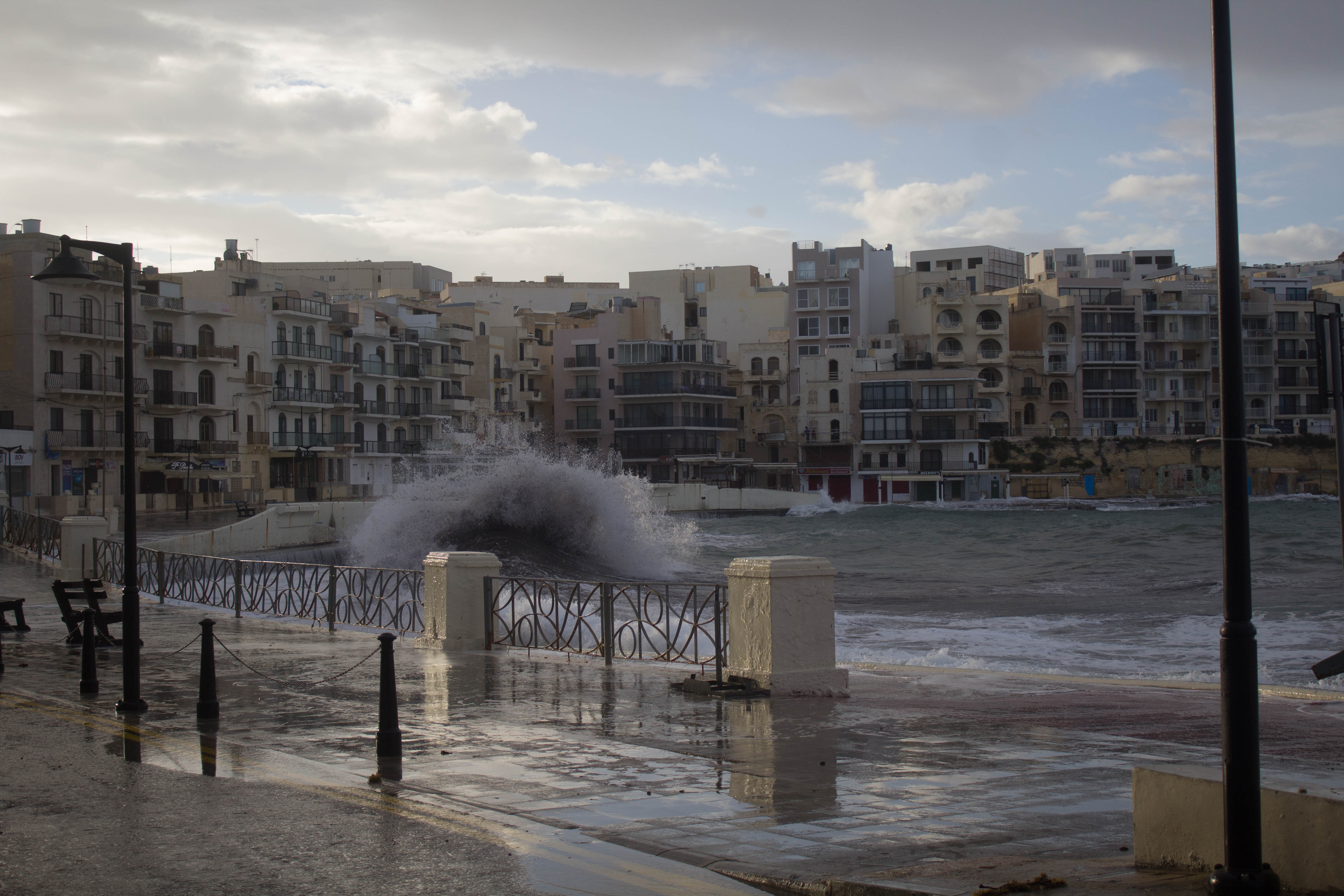
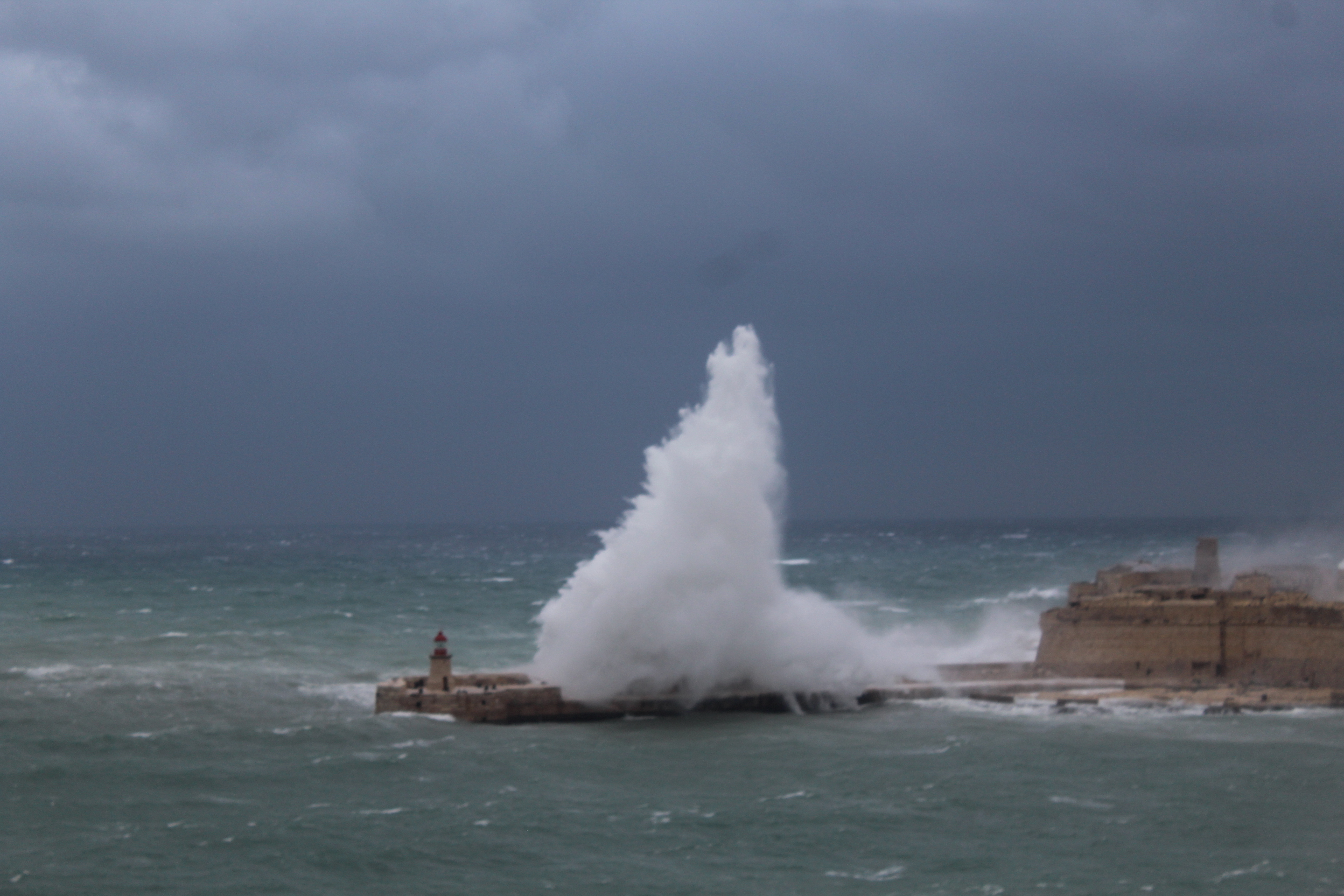
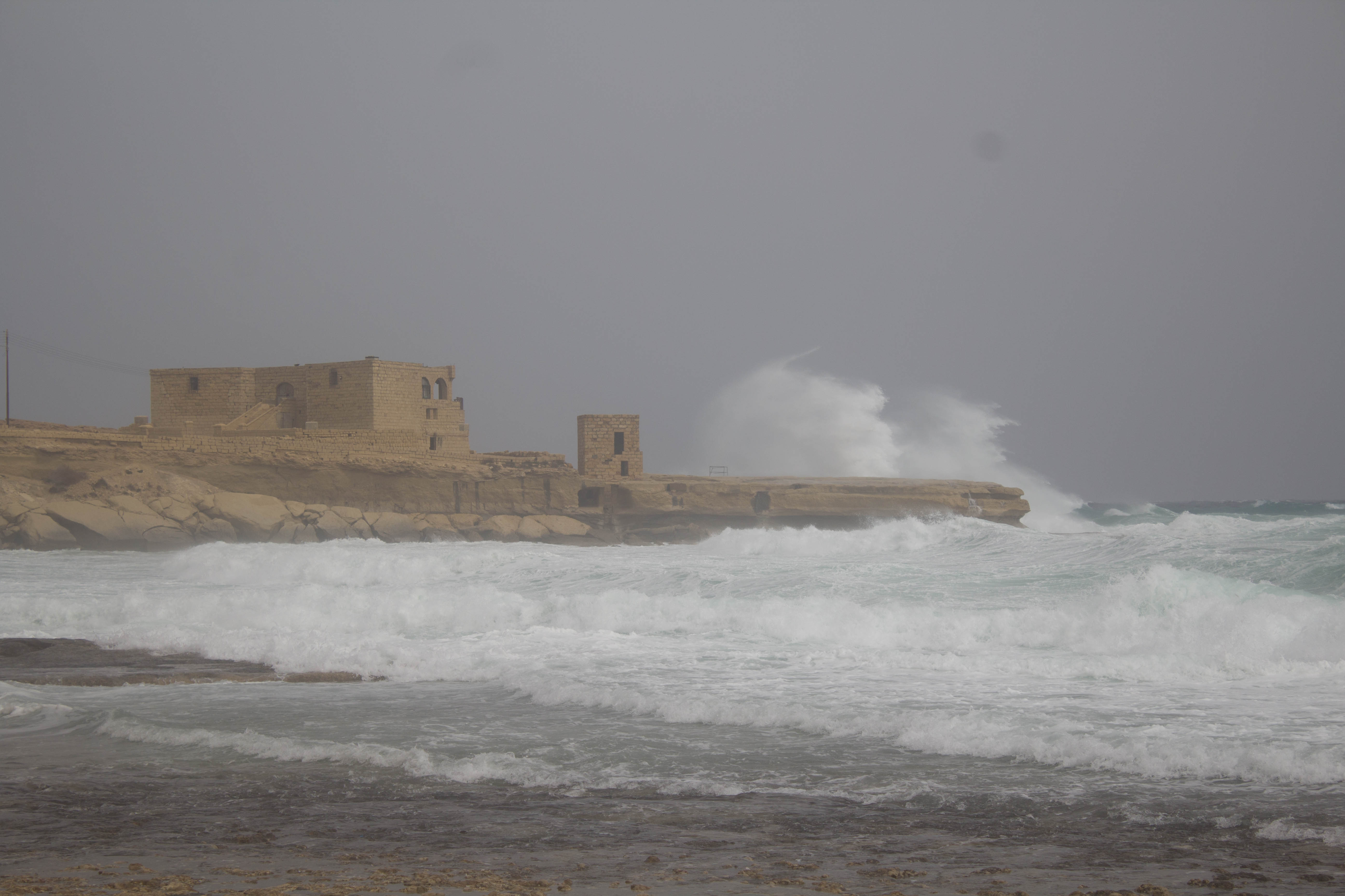
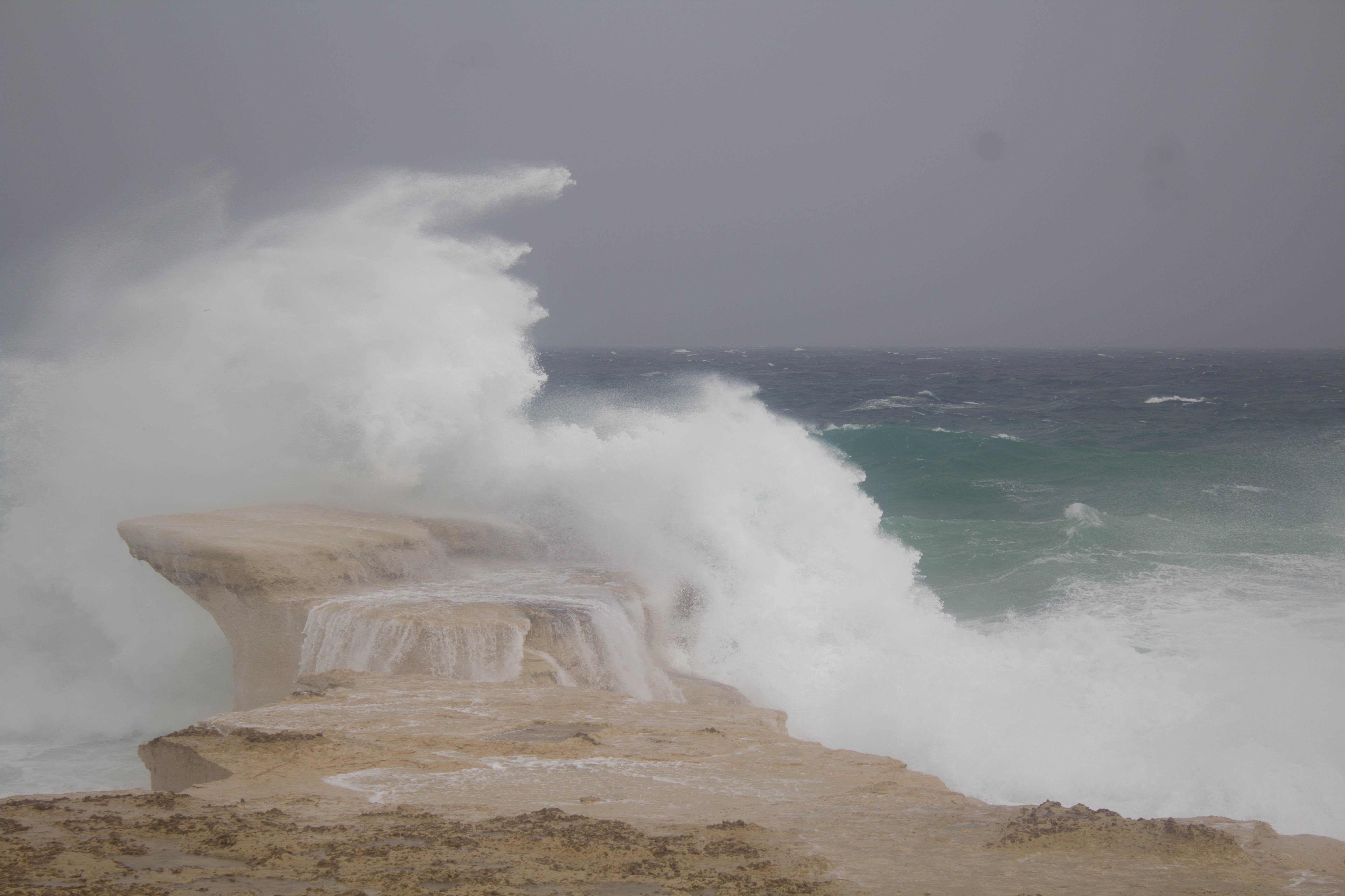
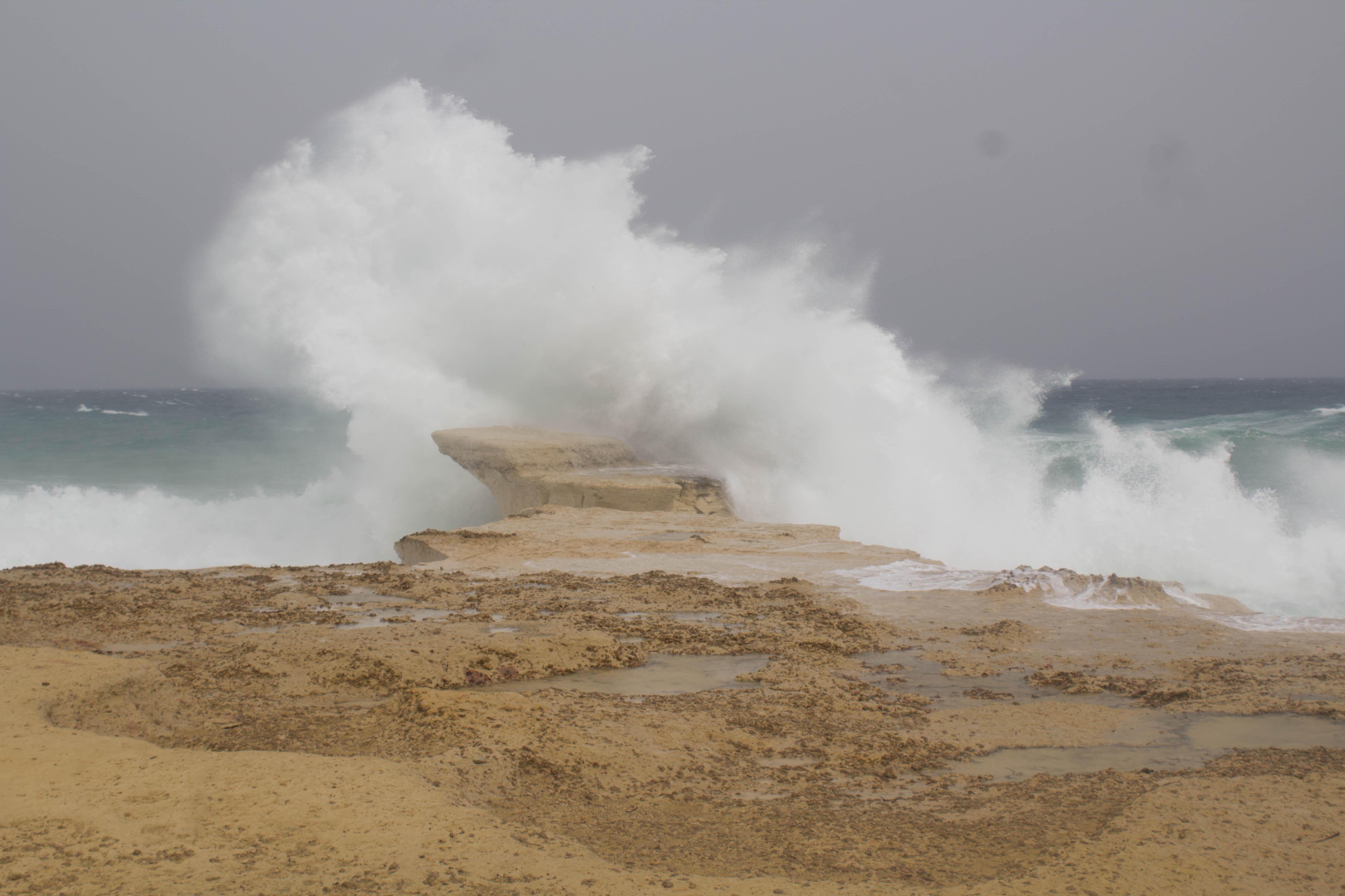
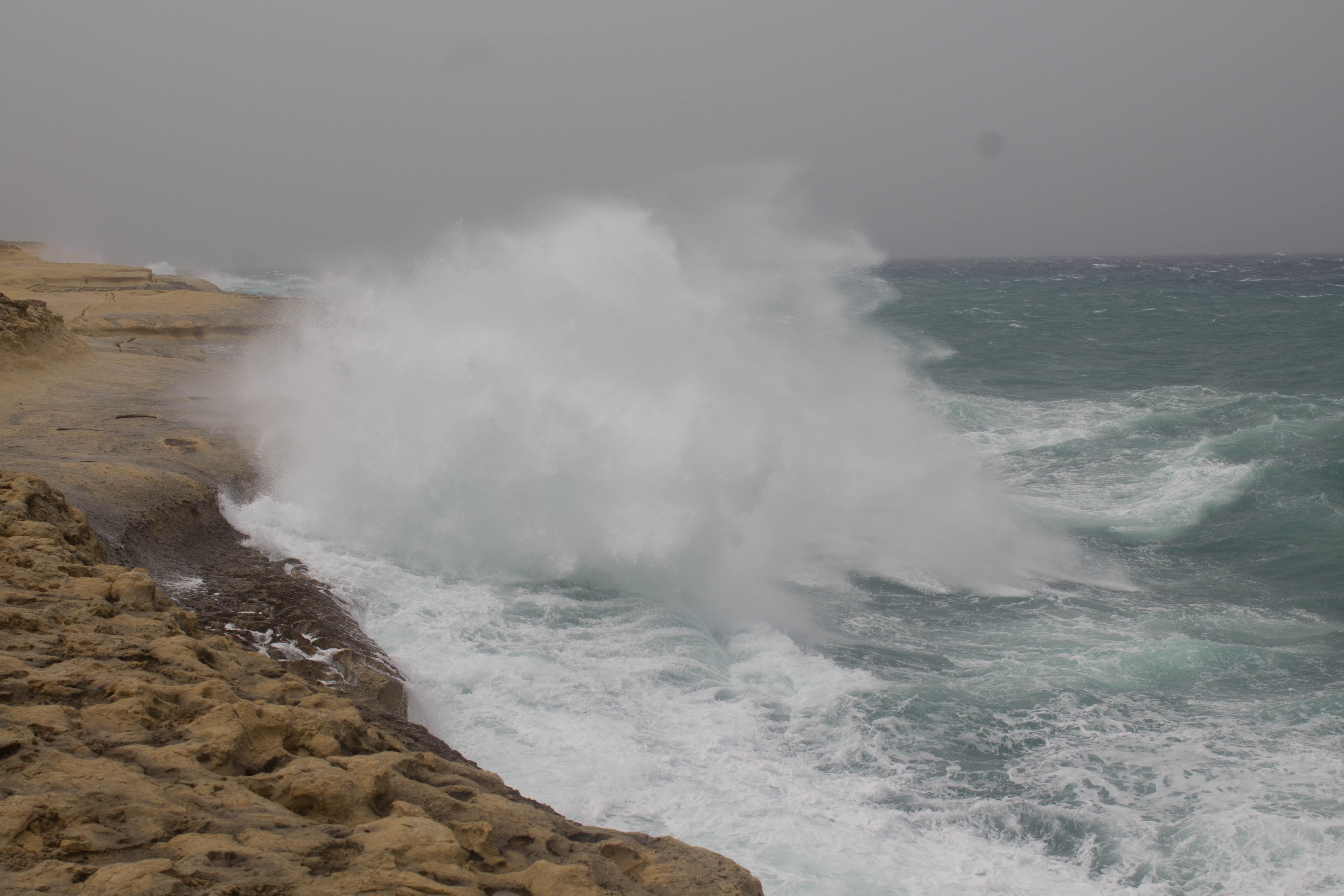
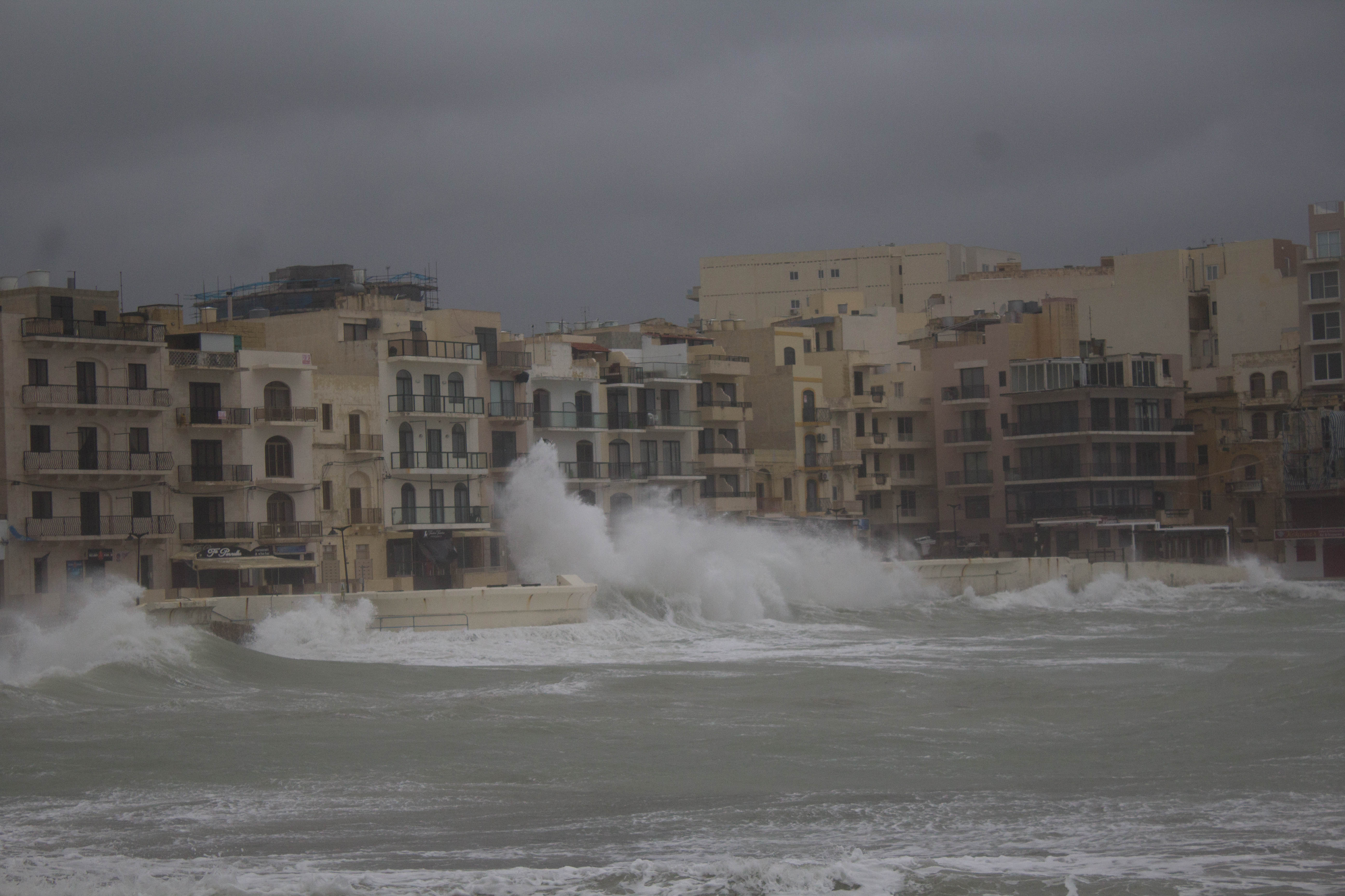
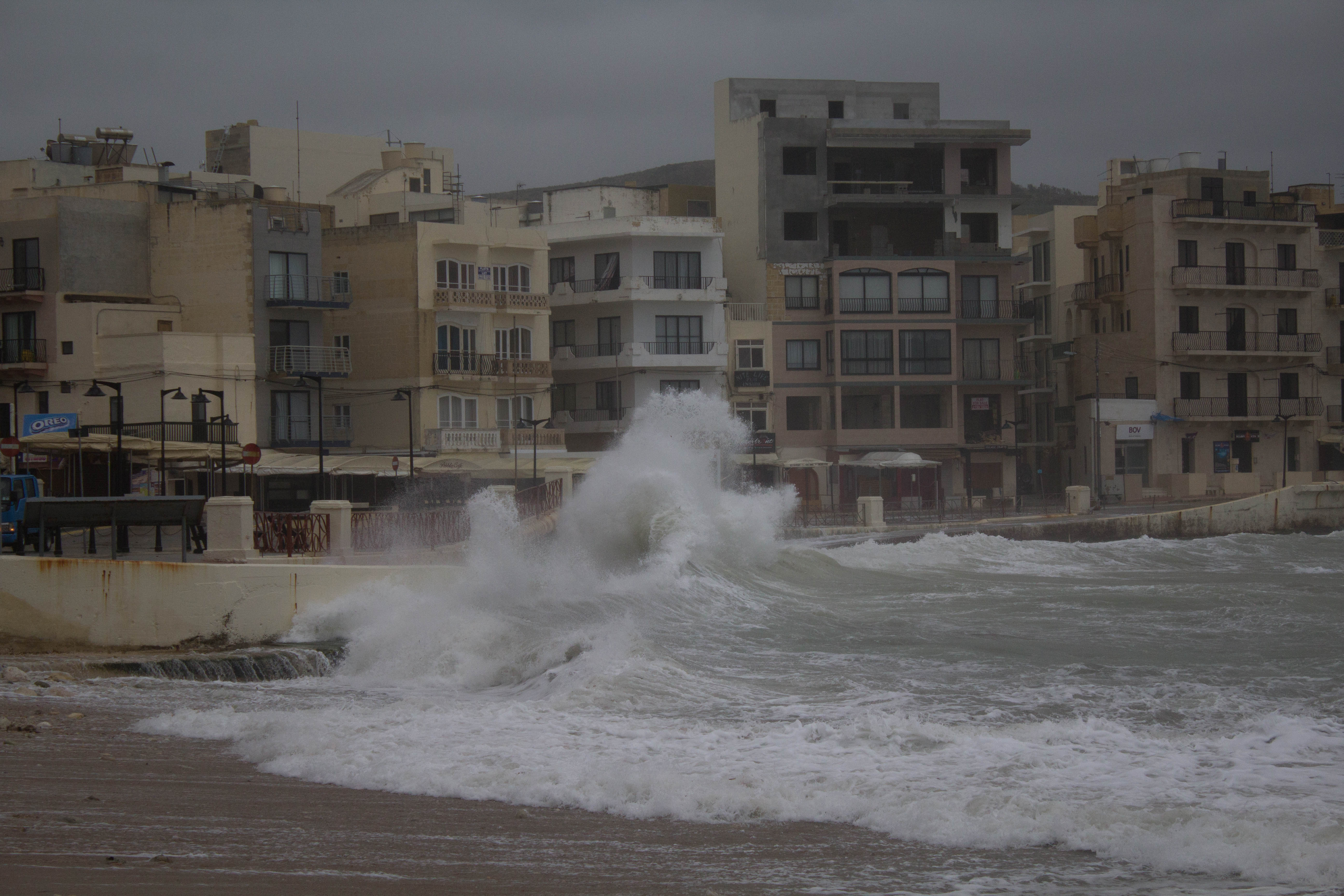
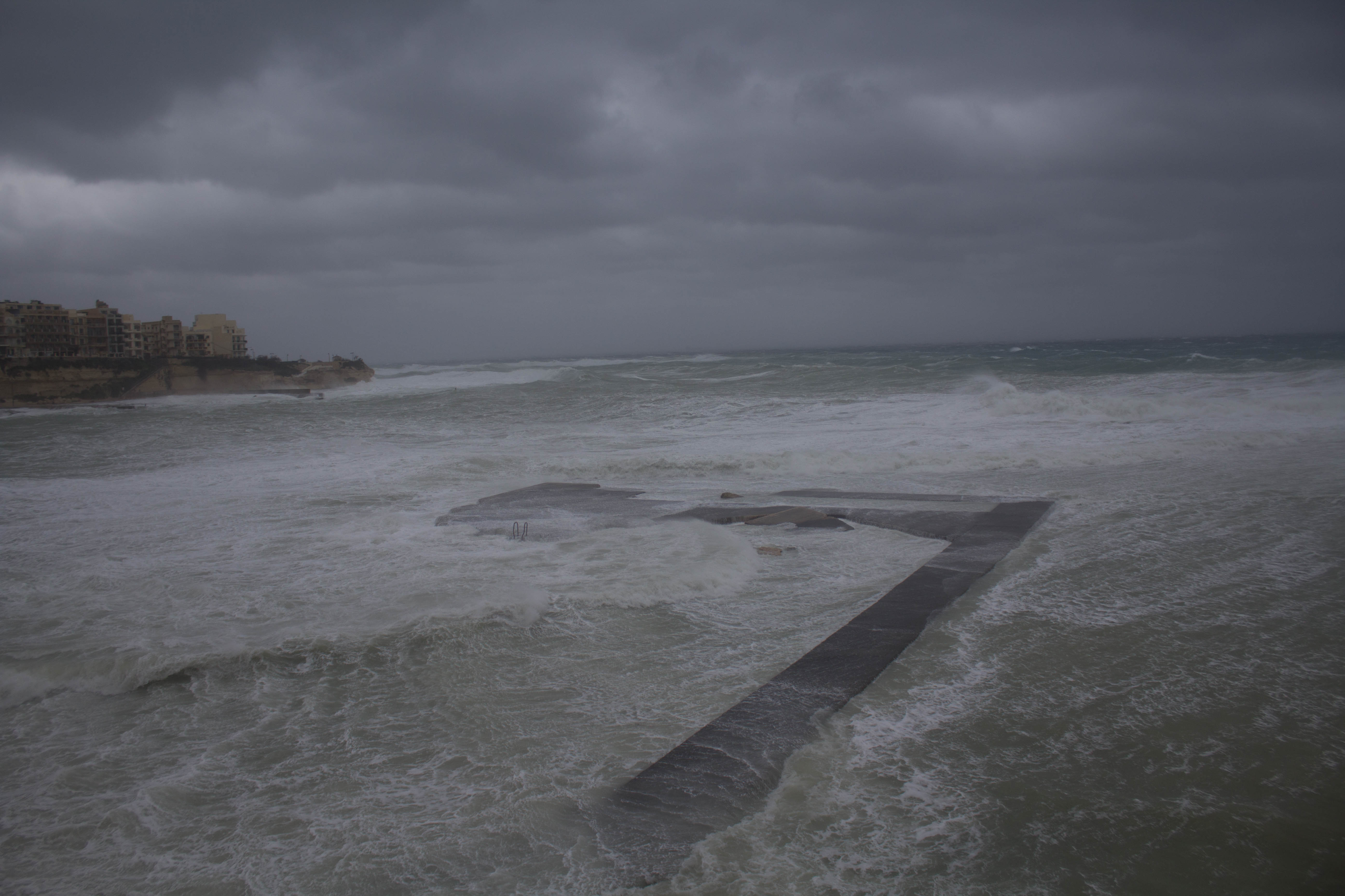
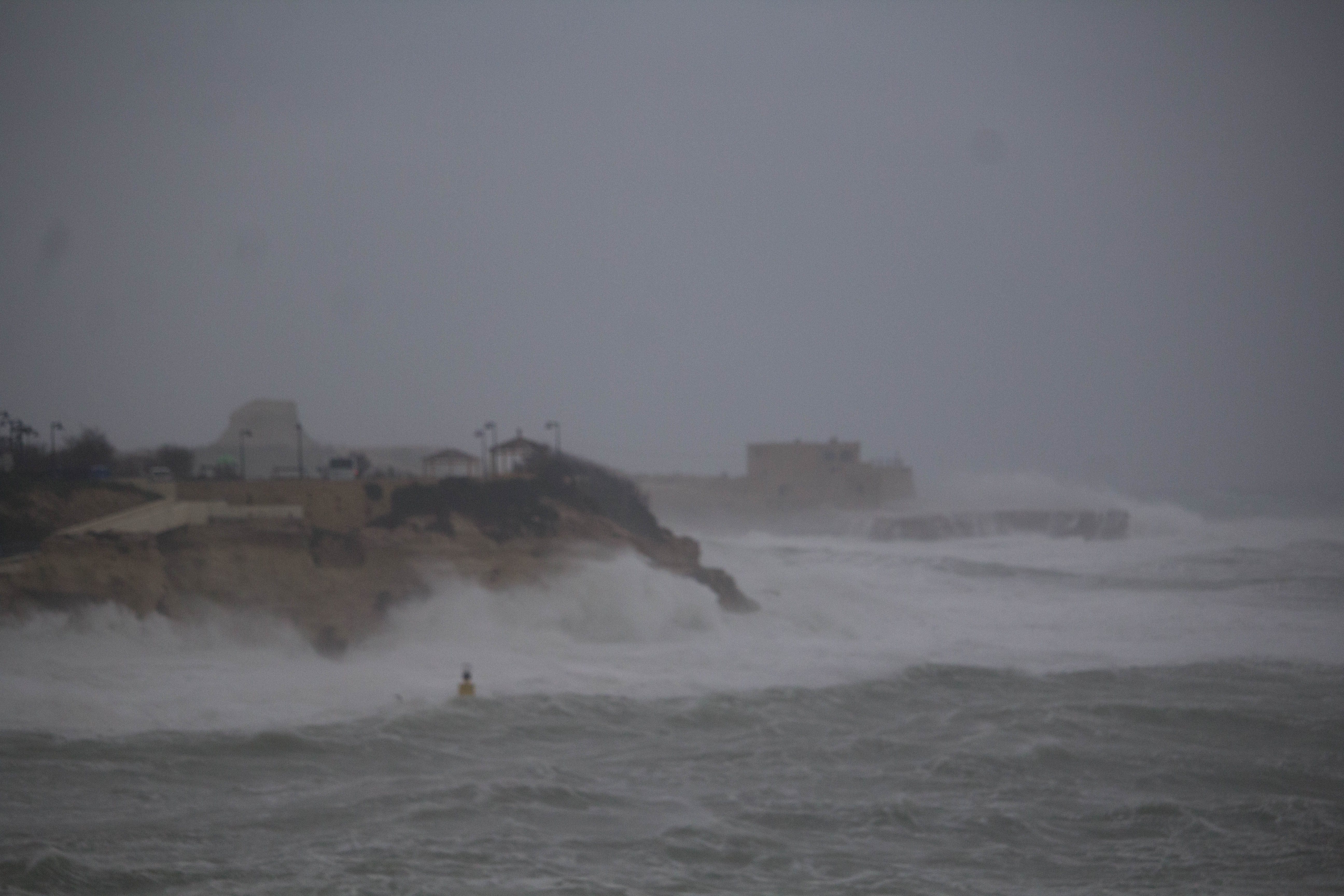
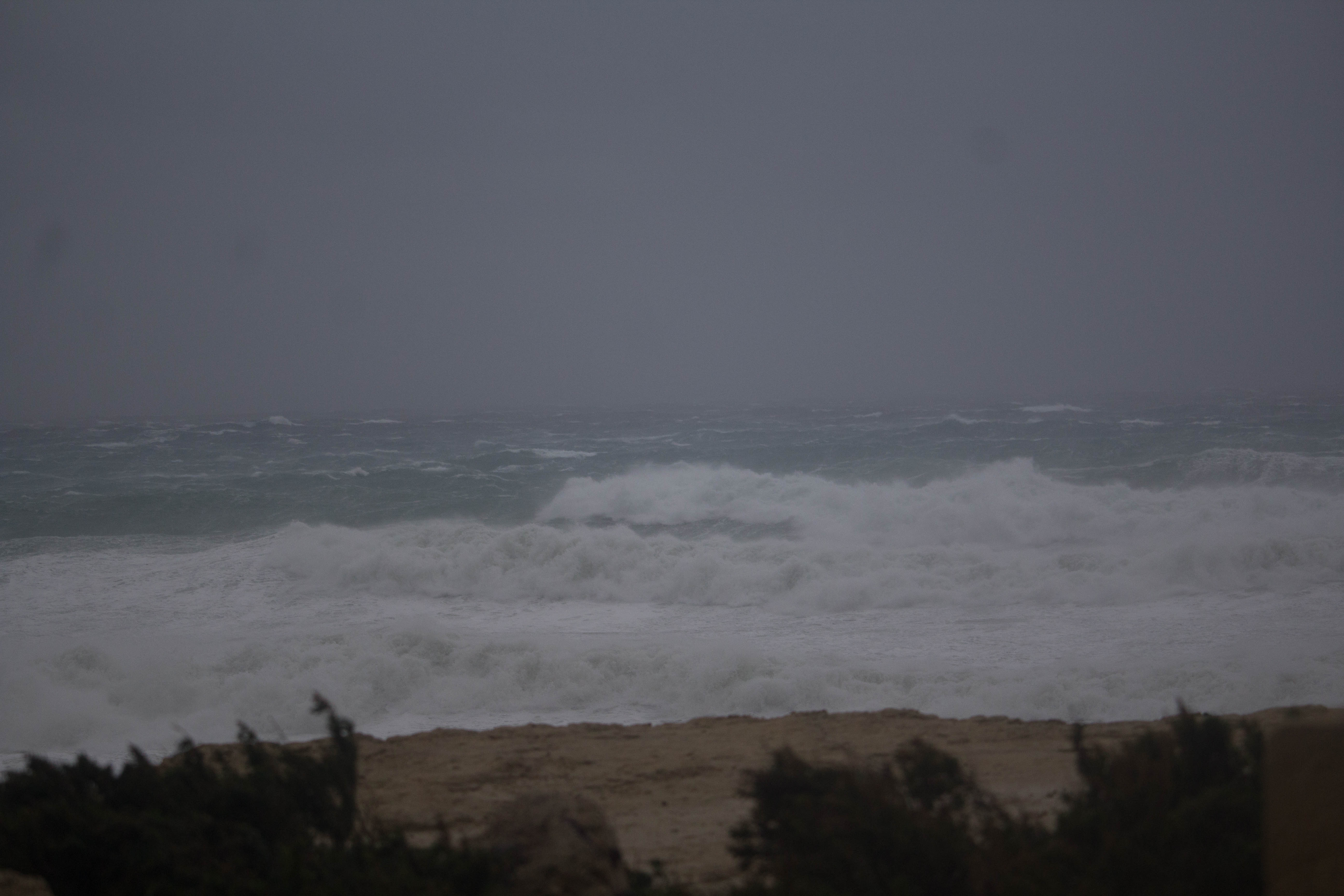
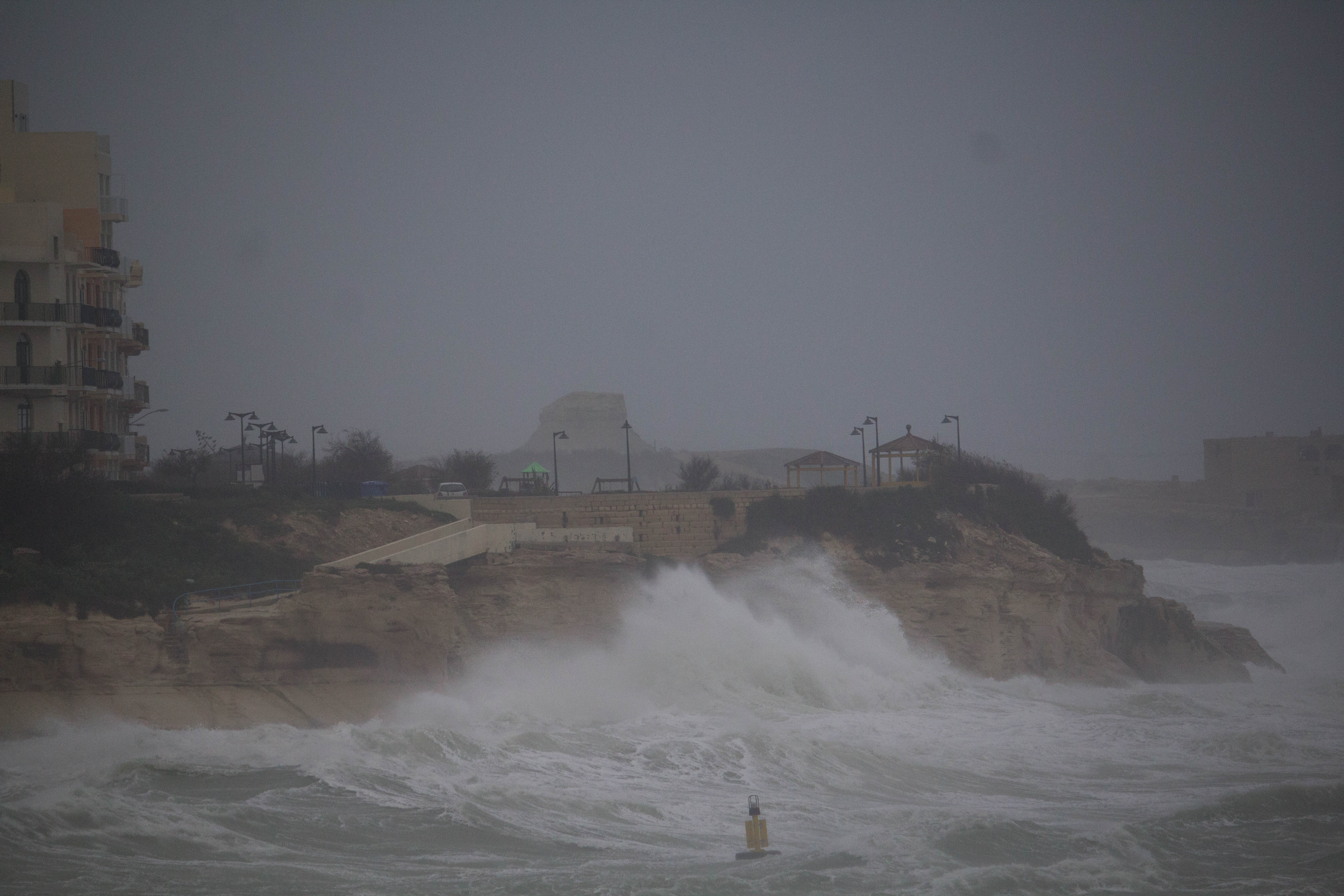
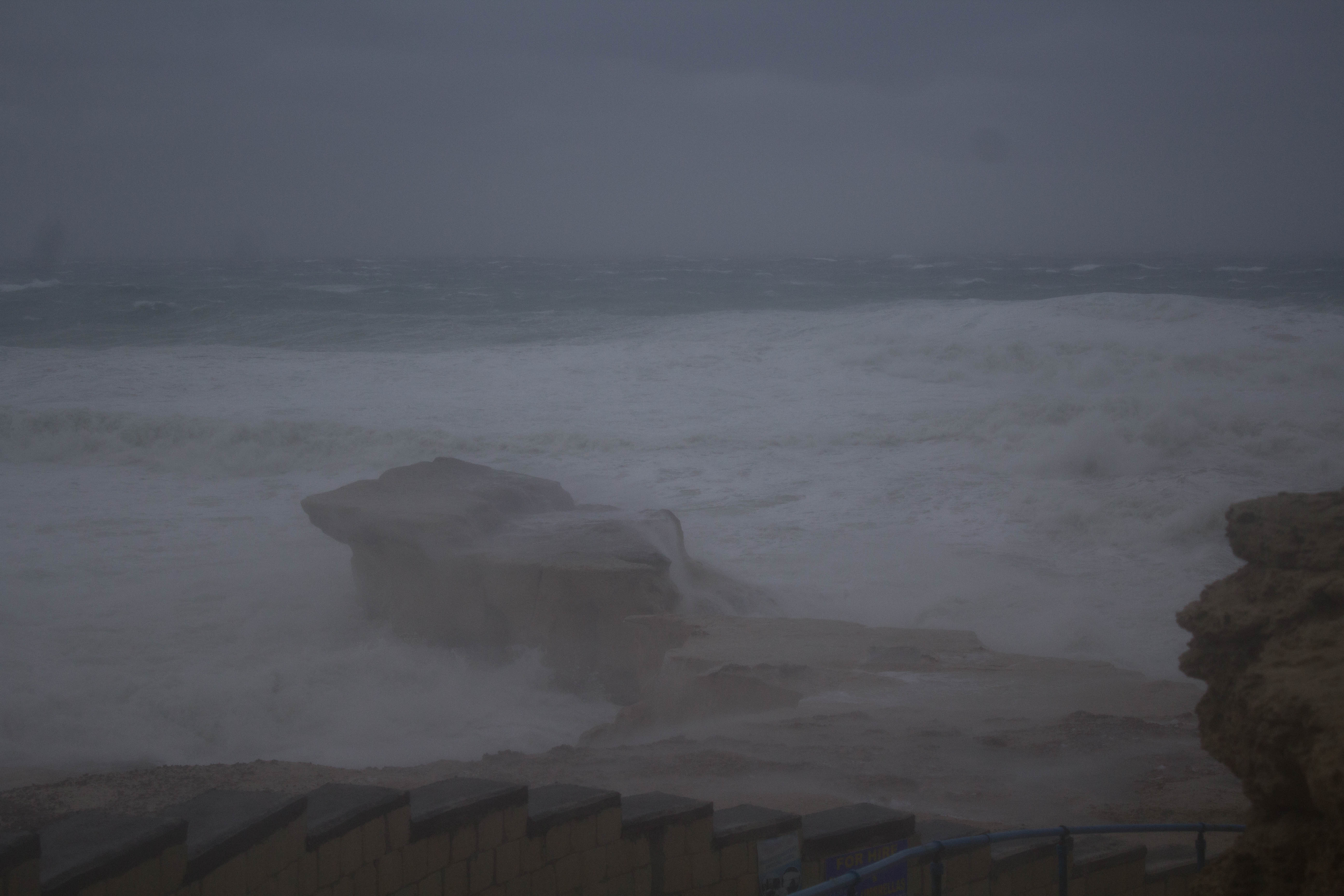
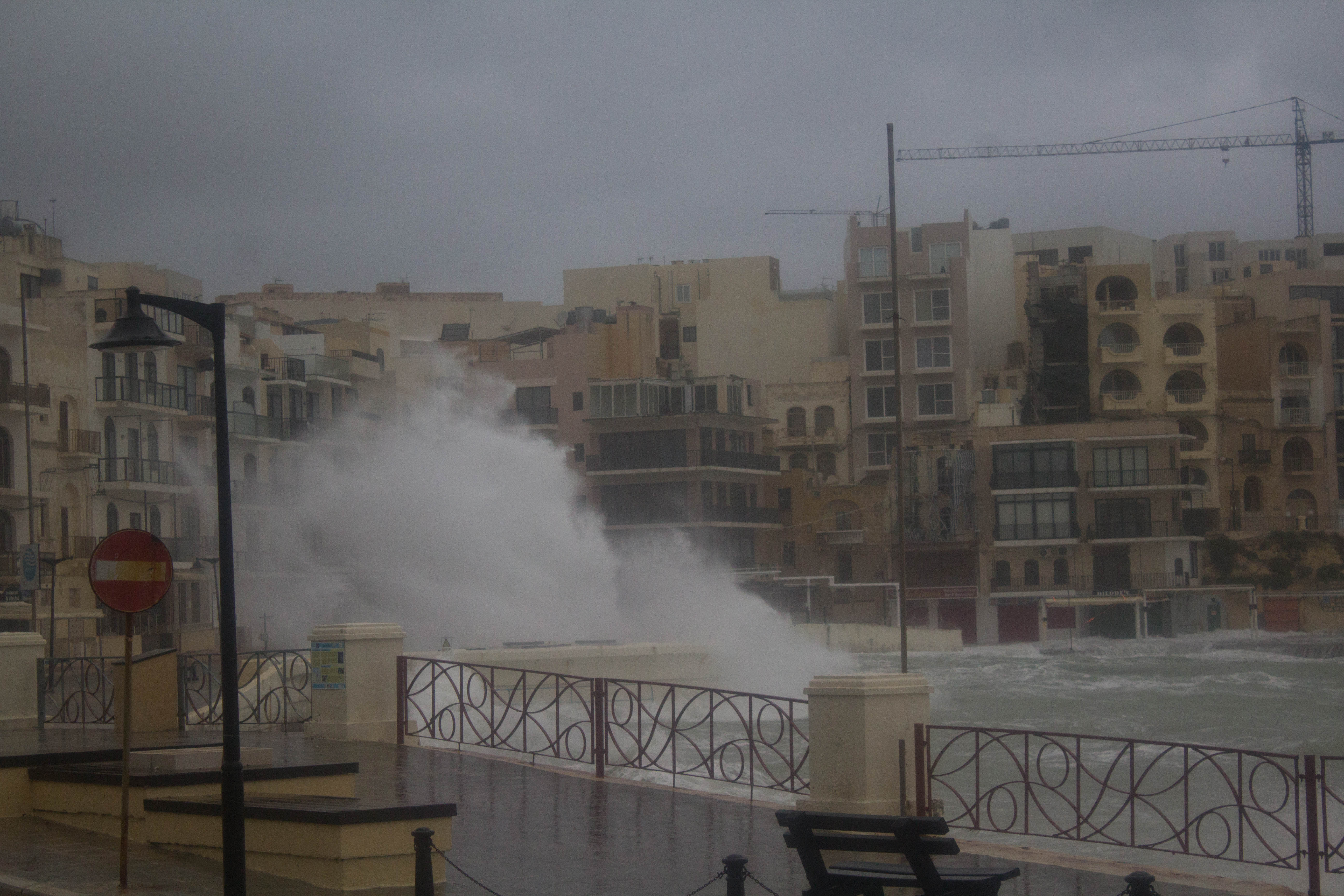
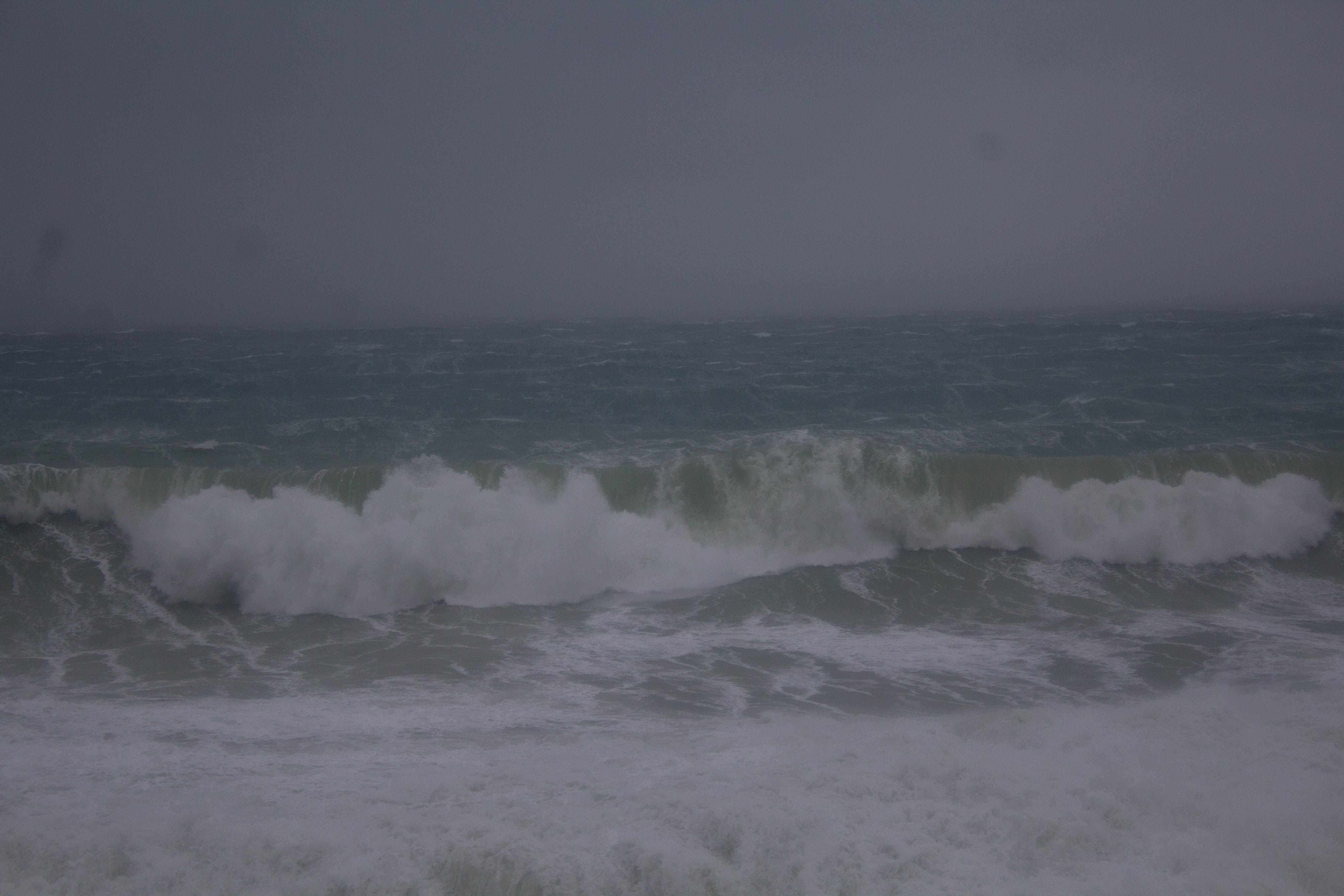
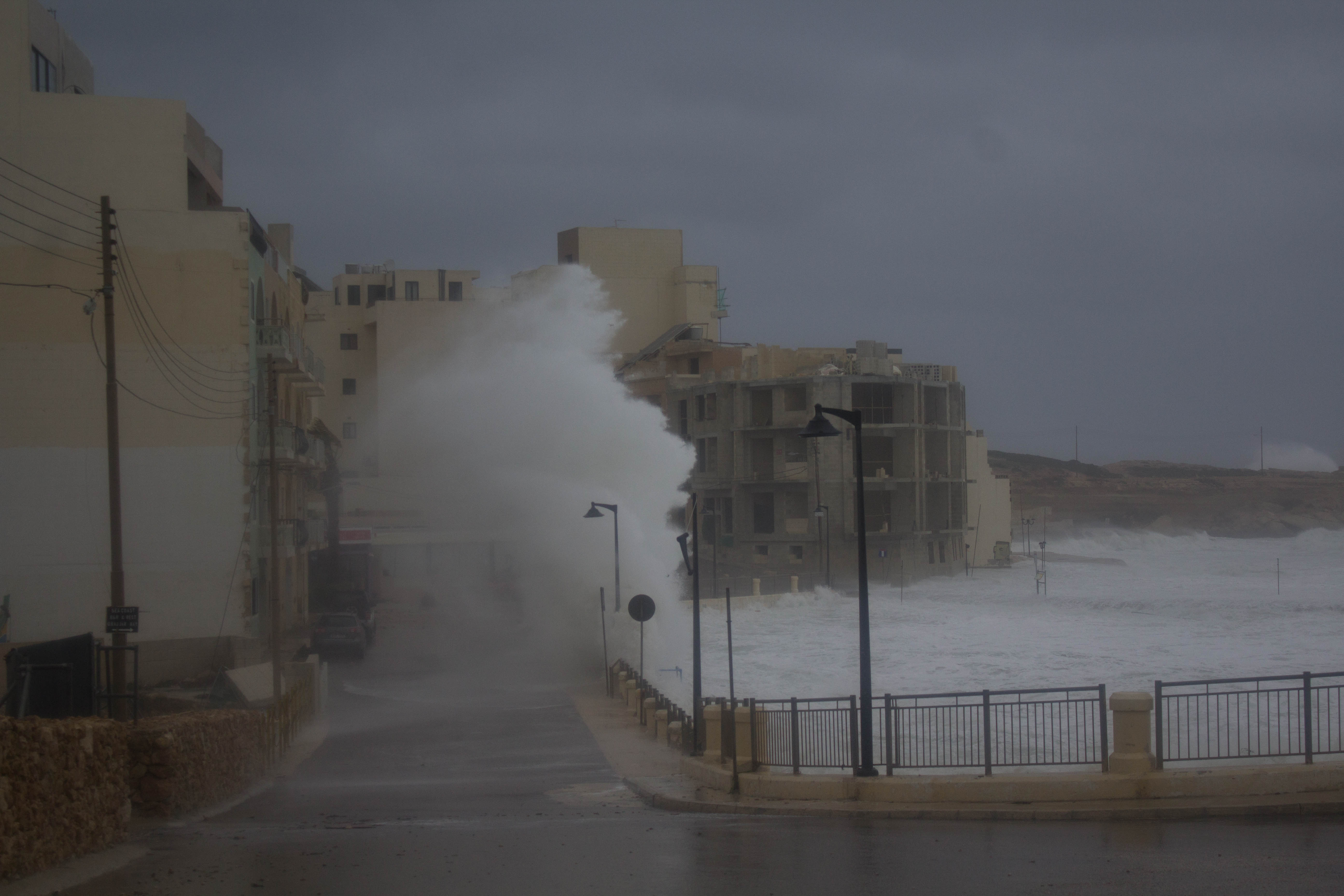
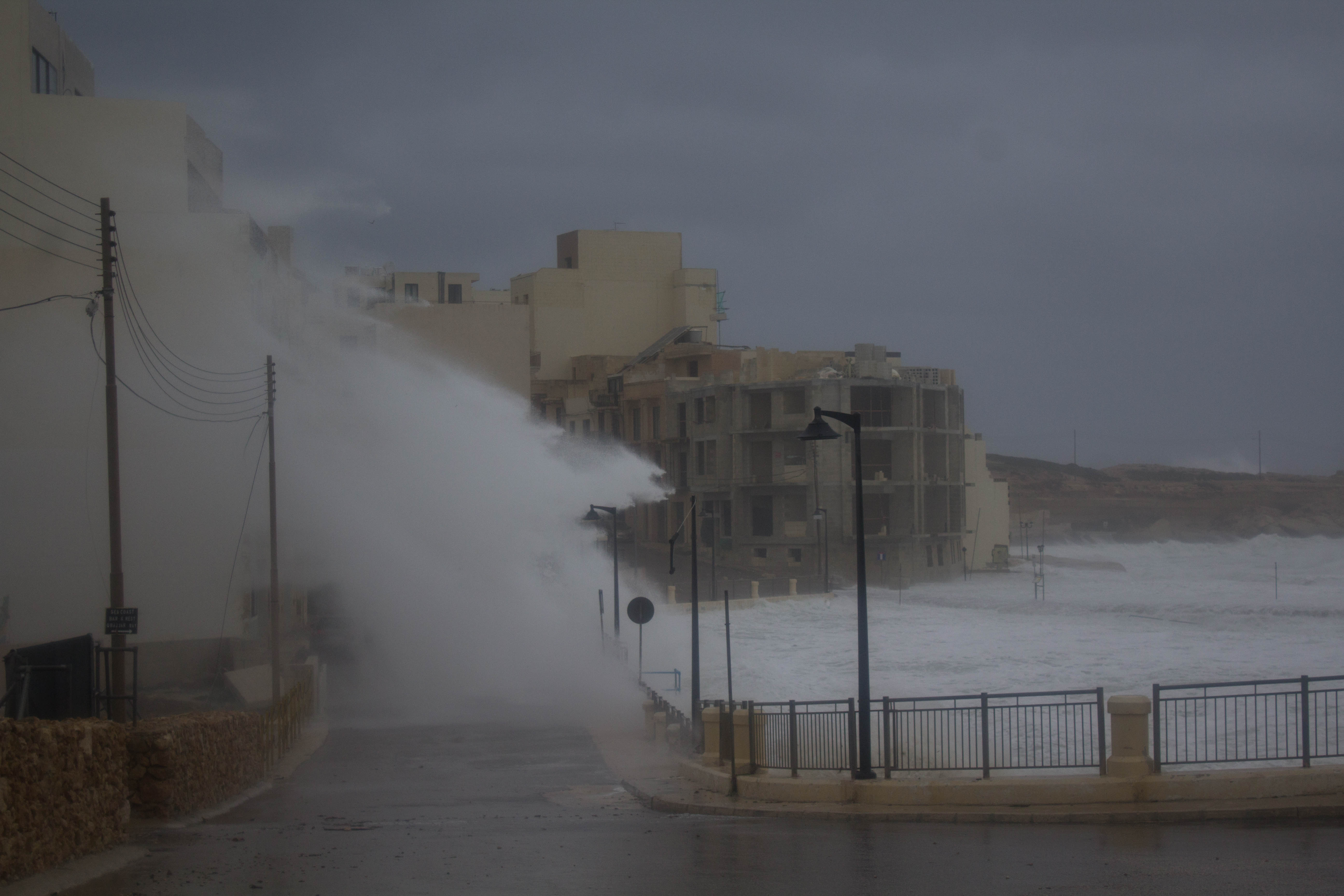
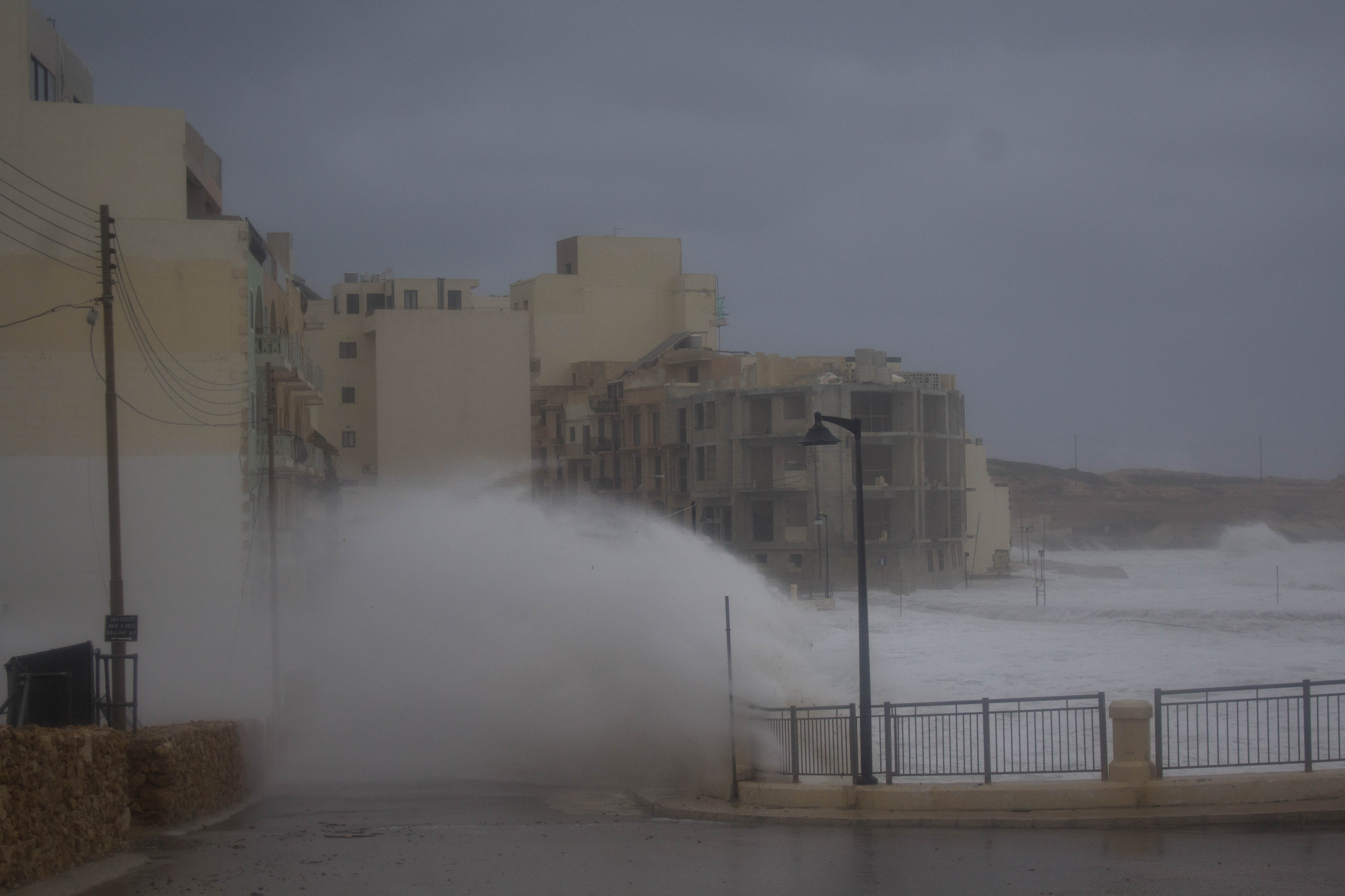
As promised, the Maltese Islands enjoyed a weekend of uninterrupted bright sunshine. High pressure which has taken hold of the central Mediterranean will prevail till late on Monday 18/03. This means another day of gloriously warm sunshine to start off the week. This high pressure will retreat south on Tuesday 19/03, however, when an area of low pressure will develop over the central Mediterranean. This will mark the brief return of wintry weather; with rain/hail showers, strong Northeasterly winds and cooler temperatures returning to the Maltese Islands. The worst of it all is expected on Thursday 21/03, when the Northeast wind should reach Force 7/8 across exposed areas of our country. This state of affairs will prevail till Friday 22/03. High pressure will once again take hold of the central Mediterranean over the weekend, promising another weekend of bright sunshine. Air temperatures will also rise again, as southerly winds blow warm air from over north Africa towards our region. This is expected to be the third heat spell of the season.

Taking a look at the weather across the Maltese Islands over the coming week, the average maximum temperature will be around 19°C, with a high for the week peaking at 22°C expected on Monday 18/03. Meanwhile, the average minimum temperature will be 12°C, dipping to its lowest in the mornings of Saturday 23/03 and Sunday 24/03 at 11°C. This week will see some significant precipitation, with rain/hail showers expected from late on Tuesday 19/03 till early on Friday 22/03. Thursday 21/03 will be the wettest, with over 10 mm. Winds are expected to be strong to very strong from the East to East Northeast on Wednesday 20/03, Thursday 21/03 and Friday 22/03, with the strongest expected on Thursday 21/03. The rest of the days will be characterised by a light breeze from the West.

Reports

GALE-FORCE WIND WARNING / TWISSIJA TA’ RIEFNU

A cold front will move across the Maltese Islands at dawn on Thursday 14/03. Meanwhile, an area of high pressure will remain almost stationary over the western Mediterranean. This meteorological situation will be generating a gale from the West Northwest across the central Mediterranean. This gale-force wind warning is valid from 03:00 on Thursday 14/03 till 00:00 on Friday 15/03. This will be updated when necessary. The details below describe how the situation will develop over this time period.


Thursday 14/03

03:00 to 06:00 – West Northwest Force 6/7

06:00 to 09:00 – West Northwest Force 7/8

09:00 to 12:00 – West Northwest Force 7/8

12:00 to 15:00 – West Northwest Force 7/8

15:00 to 18:00 – West Northwest Force 7/8

18:00 to 21:00 – West Northwest Force 7/8

21:00 to 00:00 – West Northwest Force 7/8


Friday 15/03

00:00 to 03:00 – Northwest Force 6/7

03:00 to 06:00 – Northwest Force 6/7

06:00 to 09:00 – Northwest Force 7/8

09:00 to 12:00 – Northwest Force 7/8

12:00 to 15:00 – Northwest Force 7/8

15:00 to 18:00 – Northwest Force 7/8

18:00 to 21:00 – Northwest Force 6/7

21:00 to 00:00 – Northwest Force 6/7


The peak gusts will blow across the Maltese Islands during the evening of Thursday 14/03. On Saturday 16/03, the wind will decline gradually to become Force 3/4, and turn South by evening.

The sea will be very rough, with wave heights of up to 5.0 metres in peak gusts. The swell will be a low Northwest. The map shows the area of coastline most exposed to this strong wind.


Front ta’ arja kiesħa se jgħaddi minn fuq iċ-ċentru tal-Mediterran qabel sebħ il-jum nhar il-Ħamis 14/03. Sadattant, roqgħa ta’ arja bi pressjoni għolja mistennija żżomm stazzjonarja fuq il-punent tal-Mediterran. Din is-sitwazzjoni metejoroloġika se tiġġenera riefnu mill-Punent Majjistru madwar iċ-ċentru tal-Mediterran. Din it-twissija ta’ riefnu ser tkun fis-seħħ minn 03:00 tal-Ħamis 14/03 sa 00:00 tas-Sibt 16/03. Din it-twissija se tkun aġġornata jekk ikun hemm bżonn. Id-dettalji ta’ hawn isfel jiddeskrivu kif għandha tiżviluppa s-sistema matul il-ħin imsemmi.


Il-Ħamis 14/03

03:00 sa 06:00 – Punent Majjistru Forza 6/7

06:00 sa 09:00 – Punent Majjistru Forza 7/8

09:00 sa 12:00 – Punent Majjistru Forza 7/8

12:00 sa 15:00 – Punent Majjistru Forza 7/8

15:00 sa 18:00 – Punent Majjistru Forza 7/8

18:00 sa 21:00 – Punent Majjistru Forza 7/8

21:00 sa 00:00 – Punent Majjistru Forza 7/8


Friday 15/03

00:00 sa 03:00 – Majjistral Forza 6/7

03:00 sa 06:00 – Majjistral Forza 6/7

06:00 sa 09:00 – Majjistral Forza 6/7

09:00 sa 12:00 – Majjistral Forza 6/7

12:00 sa 15:00 – Majjistral Forza 6/7

15:00 sa 18:00 – Majjistral Forza 6/7

18:00 sa 21:00 – Majjistral Forza 6/7

21:00 sa 00:00 – Majjistral Forza 6/7


Il-buffuri l-aktar qawwijin mistennija jaffetwaw lil Gżejjer Maltin matul filgħaxija talĦamis 14/03. Nhar is-Sibt 16/03, ir-riħ mistenni jnaqqas bilmod biex isir Forza 3/4, u jsir Nofsinhar, sa filgħaxija.

Il-baħar se jkun qawwi ħafna b’mewġ ogħli 5.0 metri fl-aktar buffuri qawwijin. L-imbatt se jkun ħafif mill-Majjistral. Il-mappa tindika l-kosta l-aktar esposta għal dan ir-riħ.


Reports

GALE-FORCE WIND WARNING / TWISSIJA TA’ RIEFNU

A weak cold front will move across the Maltese Islands on Monday 11/03. Meanwhile, an area of high pressure will develop over the western Mediterranean. This meteorological situation will be generating a gale from the West Northwest across the central Mediterranean. This gale-force wind warning is valid from 18:00 on Monday 11/03 till 18:00 on Tuesday 12/03. This will be updated if and when necessary. The details below describe how the situation will develop over this time period.

Monday 11/03

18:00 to 21:00 – West Northwest Force 6/7

21:00 to 00:00 – West Northwest Force 7/8

Tuesday 12/03

00:00 to 03:00 – West Northwest Force 7/8

03:00 to 06:00 – West Northwest Force 8/9

06:00 to 09:00 – West Northwest Force 8/9

09:00 to 12:00 – West Northwest Force 7/8

12:00 to 15:00 – West Northwest Force 7/8

15:00 to 18:00 – West Northwest Force 6/7


The peak gusts will blow across the Maltese Islands during the early morning of Tuesday 12/03. The wind will then decline gradually to become Force 3/4 by morning on Wednesday 13/03.

The sea will be very rough, with wave heights of up to 5.0 metres in peak gusts. The swell will be a low Northwest. The map shows the area of coastline most exposed to this strong wind.


Front dgħajjef ta’ arja kiesħa se jgħaddi minn fuq iċ-ċentru tal-Mediterran nhar it-Tnejn 11/03. Sadattant, roqgħa ta’ arja bi pressjoni għolja se tiżviluppa fuq il-punent tal-Mediterran. Din is-sitwazzjoni metejoroloġika se tiġġenera riefnu mill-Punent Majjistru madwar iċ-ċentru tal-Mediterran. Din it-twissija ta’ riefnu ser tkun fis-seħħ minn 18:00 tat-Tnejn 11/03 sa 18:00 tat-Tlieta 12/03. Din it-twissija se tkun aġġornata jekk ikun hemm il-bżonn. Id-dettalji ta’ hawn isfel jiddeskrivu kif għandha tiżviluppa s-sistema matul il-ħin imsemmi.

It-Tnejn 11/03

18:00 sa 21:00 – Punent Majjistru Forza 6/7

21:00 sa 00:00 – Punent Majjistru Forza 7/8

It-Tnejn 12/02

00:00 sa 03:00 – Punent Majjistru Forza 7/8

03:00 sa 06:00 – Punent Majjistru Forza 8/9

06:00 sa 09:00 – Punent Majjistru Forza 8/9

09:00 sa 12:00 – Punent Majjistru Forza 7/8

12:00 sa 15:00 – Punent Majjistru Forza 7/8

15:00 sa 18:00 – Punent Majjistru Forza 6/7


Il-buffuri l-aktar qawwijin mistennija jaffetwaw lil Gżejjer Maltin matul filgħodu kmieni tat-Tlieta 12/03. Ir-riħ se jnaqqas bilmod biex isir Forza 3/4 sa filgħodu nhar l-Erbgħa 13/03.

Il-baħar se jkun qawwi ħafna b’mewġ ogħli 5.0 metri fl-aktar buffuri qawwijin. L-imbatt se jkun ħafif mill-Majjistral. Il-mappa tindika l-kosta l-aktar esposta għal dan ir-riħ.

Severe Weather Reports

Dense Fog on 09/03/2019

A warm and moist air mass passed over the central Mediterranean on Saturday 09/03. The meteorological conditions were ideal for the formation of sea fog. The sea fog formed as the warm and moist air mass from the south was advected (blown) over the cooler sea around us. This caused the air mass to cool down. Its temperature fell to the dew point (the temperature at which an air mass becomes saturated and the water vapour in it condenses) polska-ed.com. For this type of fog to form and persist, the wind must be light. The light wind allows the air mass to slide slowly over the cooler area of sea increasing the chances of saturation and condensation. Often, sea fog dissipates as it moves inland. However, given that the air on land is very similar to that of the sea around us, the sea fog prevailed and engulfed the Maltese Islands.

The most affected were coastal localities along the northwest of the Maltese Islands. Conditions are very rarely ideal for the formation of this fog locally. It is only possible in spring, when the first warm and moist air masses from the south start reaching us. These clash with the still cold sea around us. The air temperature over land dropped by 10°C as the fog shrouded the Maltese Islands.

Thanks to Andrea Muscat for the photos!

End of Month Reports

February 2019 Sets New Records

Air Temperature

Highest Maximum 19.4°C 2nd
Lowest Maximum 10.6°C 24th
Highest Minimum 13.2°C 2nd
Lowest Minimum 3.9°C 23rd


Mean Maximum 15.3°C
Mean Minimum 9.7°C
Mean 12.5°C


Relative Humidity

Highest Relative Humidity 74% 4th, 5th, 23rd and 26th
Lowest Relative Humidity 40% 23rd


Mean Relative Humidity 60.6%


Atmospheric Pressure

Highest Atmospheric Pressure 1030hPa 15th, 17th and 18th
Lowest Atmospheric Pressure 1002hPa 2nd


Mean Atmospheric Pressure 1019.9hPa


Wind

Highest Gust 101.0km/h 24th


Mean Wind Speed 11.0km/h
Mean Gust Speed 40.1km/h
Mean Wind + Gust Speed 25.6km/h
Most Frequent Wind Direction Northwest


Precipitation

Total Rainfall During February 2019 39.1 mm
Total Rainfall Since Last 01/09 398.3 mm


Highest 24 Hour Total 11.6 mm 5th


Rain Days 9
Thunderstorm Days 4
Hail Days 2


Rainfall Events

03/02/2019 3.2 mm Thunder Rain and Hail Shower
04/02/2019 10.2 mm Periods of Steady Rain
05/02/2019 11.6 mm Thundery Rain and Hail Shower
07/02/2019 0.6 mm Rain Shower
09/02/2019 0.9 mm Rain Shower
16/02/2019 0.8 mm Rain Shower
23/02/2019 6.9 mm Rain and Hail Showers
24/02/2019 2.8 mm Rain and Hail Showers
28/02/2019 3.0 mm Rain Shower


February 2019 Compared to the Climate Means

  Climate Mean February 2019 Anomaly
Mean Maximum Temperature 15.7°C 15.3°C -0.4°C
Mean Minimum Temperature 9.5°C 9.7°C +0.2°C
Mean Temperature 12.6°C 12.5°C -0.1°C
Mean Relative Humidity 78% 60.6% -17.4%
Mean Atmospheric Pressure 1016.6hPa 1019.9hPa +3.3hPa
Mean Wind Speed 19.1 km/h 25.6km/h +6.5km/h
Most Frequent Wind Direction Northwest Northwest
Total Rainfall 61.6 mm 39.1 mm -29.2 mm
Total Rainfall Since Last 01/09 497.8 mm 398.3 mm -99.5 mm
Total Rain Days 11 9 -2
Total Thunderstorm Days 3 4 +1
Total Hail Days 1 2 +1


February 2019 Sets New Records

The month of February was around average with regards to temperature. Averaging at 12.5˚C, the mean air temperature was only 0.1˚C colder than the norm. Rainfall in February was substantially below the mean at our Għarb weather station. Despite this, most localities in the Maltese Islands experienced a wetter February, particularly across central and southern Malta. The total of 39.1 mm fell over 9 days. Hail was observed on 4 of these. Thunder was heard on only 2 days, however. February set new records with regards to wind. February is typically a windy month. This year, it was certainly no different. The highest gust last month was registered at 101km/h from the Southeast. This was the strongest ever recorded at our weather station in Għarb. It was during the worst Gregalata since 1982.


Severe Weather Reports

Severe Gregale on 23&24/02/2019

This was the strongest wind since the year 1982. A gust of 101km/h (Force 10) broke the long-standing wind gust record at our weather station in Għarb. The storm-force winds left behind a trail of destruction. In this report, we’ll describe what gave rise to this intense system and why it affected the Maltese Islands so badly.

It was classified as an intense Mediterranean cyclone. The Mediterranean cyclone that formed late on Saturday 23/02 and lasted till late on Sunday 24/02, was the very first since the one in November 2014. A strong jet-stream blew some very warm and humid air masses from the Ionian Sea, the Gulf of Gabes and the Gulf of Sirte towards the central Mediterranean. Simulateneously, frigid air from over the Balkans penetrated the central Mediterranean, initiating the process of Mediterranean Cyclone development. This cold air mass caused temperatures to drop rapidly all around the Maltese Islands. In fact, the temperature at our weather station in Għarb dropped by over 11°C in around 3 hours; starting at 15.4°C and dipping to 3.9°C. That is also the coldest so far this winter. The strong wind made temperatures feel even colder. Here, in the central Mediterranean both air masses clashed together. The ingredients were in place for an intense Mediterranean Cyclone to develop. As a result of their clash, an existing low pressure system started intensifying very quickly, in a process referred to as cyclogenesis in meteorology. In fact, atmospheric pressure at its center dropped drastically, and a Mediterranean Cyclone was officially formed.

The Mediterranean Cyclone affected Malta from late on Saturday 23/02 and lasted till late on Sunday 24/02 . As the cyclone made its way towards Malta, the islands were affected by several bands of convection located around the storm’s center. These produced heavy rain and thunderstorms. Some of the thunderstorms were very strong with severe gusts, moderate hail and funnel events. The storm generated waves of up to 10.1 metres and a storm surge.

According to weather stations, close to 100 mm of rain was measured in less than 24 hours in the worst hit areas. The storm-force winds produced substantial damage. The damage included uprooted trees, collapsed walls and downed power lines. The latter caused lengthy power-cuts in some areas. A number of areas suffered extensive flooding high enough to carry cars in some areas. The very high waves and storm surge caused great damage to coastal resorts, leading to a number of small sandy beaches being washed away.


End of Month Reports

Colder January 2019

Air Temperature

Highest Maximum 17.2°C 18th
Lowest Maximum 10.6°C 4th
Highest Minimum 12.4°C 18th
Lowest Minimum 5.7°C 5th


Mean Maximum 14.2°C
Mean Minimum 9.4°C
Mean 11.8°C


Relative Humidity

Highest Relative Humidity 74% 14th and 18th
Lowest Relative Humidity libido-de.com/ 27% 7th


Mean Relative Humidity 58.3%


Atmospheric Pressure

Highest Atmospheric Pressure 1026.3hPa 4th and 16th
Lowest Atmospheric Pressure 987hPa 25th


Mean Atmospheric Pressure 1013.0hPa


Wind

Highest Gust 77.2km/h 14th


Mean Wind Speed 13.6km/h
Mean Gust Speed 44.2km/h
Mean Wind + Gust Speed 28.9km/h
Most Frequent Wind Direction Northwest


Precipitation

Total Rainfall During January 2018 64.9 mm
Total Rainfall Since Last 01/09 359.2 mm


Highest 24 Hour Total 12.1 mm 9th


Rain Days 19
Thunderstorm Days 2
Hail Days 6


Rainfall Events

03/01/2019 1.3 mm Light Rain and Hail
06/01/2019 2.5 mm Light Rain and Hail
09/01/2019 12.1 mm Showers
10/01/2019 1.0 mm Light Rain
11/01/2019 2.0 mm Light Rain
12/01/2019 0.3 mm Light Rain
13/01/2019 2.0 mm Showers
14/01/2019 7.9 mm Showers
17/01/2019 2.4 mm Showers
19/01/2019 3.6 mm Showers
20/01/2019 6.6 mm Thundery Rain and Hail Showers
22/01/2019 2.8 mm Showers
23/01/2019 0.8 mm Light Rain
24/01/2019 8.4 mm Rain and Hail Showers
25/01/2019 6.4 mm Rain and Hail Showers
26/01/2019 1.7 mm Showers
27/01/2019 0.3 mm Light Rain
29/01/2019 2.3 mm Thundery Rain and Hail Showers
30/01/2019 0.5 mm Light Rain


January 2019 Compared to the Climate Means

  Climate Mean January 2019 Anomaly
Mean Maximum Temperature 15.6°C 14.2°C -1.4°C
Mean Minimum Temperature 9.8°C 9.4°C -0.4°C
Mean Temperature 12.7°C 11.8°C -0.9°C
Mean Relative Humidity 79% 58.3% -20.7%
Mean Atmospheric Pressure 1018.2hPa 1013.0hPa -5.2hPa
Mean Wind Speed 18.9 km/h 28.9km/h +10.0km/h
Most Frequent Wind Direction Northwest Northwest
Total Rainfall 94.1 mm 64.9 mm -29.2 mm
Total Rainfall Since Last 01/09 436.2 mm 359.2 mm -77.8 mm
Total Rain Days 14 19 +5
Total Thunderstorm Days 3 2 -1
Total Hail Days 1 6 +5


Colder January 2019

The month of January was noticeably colder than average. Averaging at 11.8˚C, the mean air temperature was 0.9˚C colder than the norm. The difference was far more pronounced in the daytime highs. Rainfall in January was below the average for this time of year at our weather station in Għarb. Despite this, most localities in the Maltese Islands experienced a wetter January. The total of 64.9 mm fell over 19 days. Hail was observed on 6 of these. Thunder was hard on only 2 days, however. According to measurements at our Għarb weather station, the Maltese Islands have started falling behind in total rainfall since last September 1st. January is typically a windy month, locally. This year, it was no different. The highest gust last month was registered at 77.2 km/h from the Northwest. Several other gales occured over the course of the month. Overall, January was more blustery than usual. The average wind speed of 28.9 km/h was far higher than the climate norm for this parameter.