STRONG WIND WARNING / TWISSIJA TA’ RIĦ QAWWI
ENGLISH/INGLIŻ
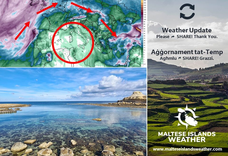
A cold front associated with an intense low pressure system over northern Italy will traverse the central Mediterranean. In the meantime, a zone of high pressure will be developing across the western Mediterranean. This will generate a strong to very strong Northwest to North Northwest wind across the central Mediterranean. This warning is valid from 06:00 till 23:59 on Tuesday 23rd March. The warning will be updated when and if necessary. The information below describes how the situation will develop over this time period:
Tuesday 23/3
06:00 to 09:00 – Northwest Force 5 to 6
09:00 to 12:00 – Northwest Force 6 to 7
12:00 to 15:00 – Northwest to North Northwest Force 7 to 8
15:00 to 18:00 – North Northwest Force 7 to 8
18:00 to 21:00 – North Northwest Force 6 to 7
21:00 to 23:59 – North Northwest Force 5 to 6
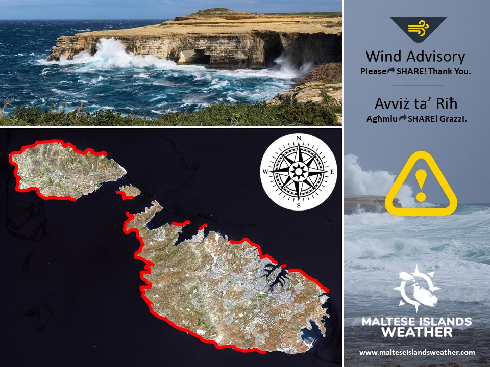
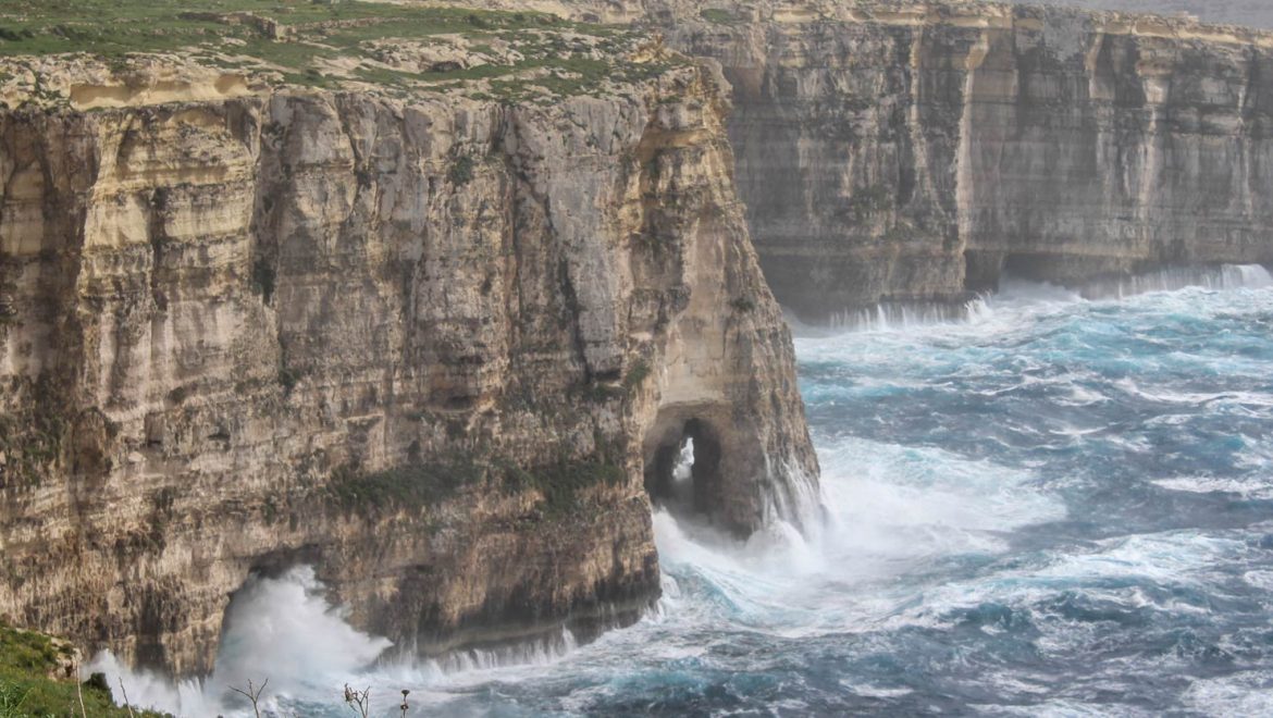
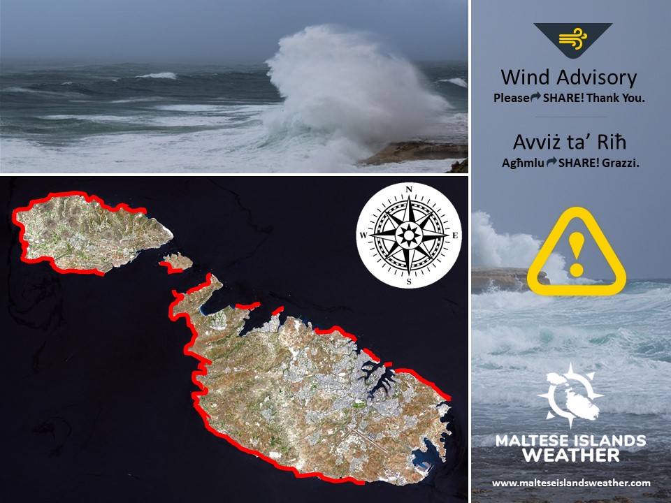
The peak gusts will blow across the Maltese Islands in the afternoon on Tuesday 23rd March, when they will reach Force 8 at times across exposed areas of the Maltese Islands. The sea will be very rough, with wave heights of up to 4.5 metres in peak gusts. The swell will be a low Northwest. The map below shows the coast most exposed to this strong wind and rough sea.
The wind will be mainly moderate from the North Northwest on Wednesday 24th March.
MALTI / MALTESE
Front kiesaħ abbinat ma’ sistema intensa ta’ pressjoni baxxa lejn in-naħa ta’ fuq ta’ l-Italja se jgħaddi minn fuq iċ-ċentru tal-Mediterran. Fl-istess ħin, sistema ta’ pressjoni għolja se tkun qed tiżviluppa fuq il-punent tal-Mediterran. Dan se joħloq riħ qawwi għal qawwi ħafna mill-Majjistral għal Majjistral it-Tramuntana madwar iċ-ċentru tal-Mediterran. Din it-twissija tkun fis-seħħ minn 06:00 sa 23:59 tat-Tlieta 23 ta’ Marzu. It-twissija tkun aġġornata jekk ikun hemm bżonn. Id-dettalji ta’ hawn taħt jindikaw kif se tiżviluppa din is-sitwazzjoni matul dan il-ħin:
It-Tlieta 23/3
06:00 sa 09:00 – Majjistral Forza 5 għal 6
09:00 sa 12:00 – Majjistral Forza 6 għal 7
12:00 sa 15:00 – Majjistral għal Majjistral it-Tramuntana Forza 7 għal 8
15:00 sa 18:00 – Majjistral it-Tramuntana Forza 7 għal 8
18:00 sa 21:00 – Majjistral it-Tramunatan Forza 6 għal 7
21:00 sa 23:59 – Majjistral it-Tramuntana Forza 5 għal 6
Il-buffuri l-aktar qawwija se jolqtu lill-Gżejjer Maltin matul wara nofsinhar tat-Tlieta 23 ta’ Marzu, x’ħin se jilħqu sa Forza 8 kultant fl-inħawi l-aktar esposti tal-Gżejjer Maltin. Il-baħar se jkun imqalleb ħafna, b’mewġ għoli 4.5 metri fil-buffuri l-aktar qawwija. L-imbatt se jkun baxx mill-Majjistral. Il-mappa ta’ hawn taħt turi l-kosta l-aktar esposta għal dan ir-riħ qawwi u baħar imqalleb.
Ir-riħ se jibqa moderat mill-Majjistral it-Tramuntana matul il-jum ta’ l-Erbgħa 24 ta’ Marzu.