
According to climate data, the mean temperature in February is of 12.6°C (a 15.7°C high and a 9.5°C low). Total precipitation in a typical February amounts to 61.6 mm. February often marks the start of a gradual decline in monthly rainfall, which eventually culminates in the dry summer months. Climatically, February is a continuation of the coldest part of a typical year. A typical February would be characterized by one or two cold snaps. Spells of warmer weather in between is not unusual. The bulk of the rain that falls in February is often the product of showers brought about by cold fronts traversing the central Mediterranean. Most showers at this time of year are accompanied by small hail. A few showers are known to bring abundant amounts of hail to localized areas. Some frontal systems also bring the occasional episode of continuous light to moderate rainfall with the potential of producing significant rainfall amounts. Northwesterly gales are common during February. It is also not unheard of for an episode of violent Gregale to affect the Maltese Islands at this time of year.
The majority of long-term weather models expect February 2022 to bring temperatures which are around or slightly below the norm. A warmer spell towards the end of the month cannot be completely ruled out. Although episodes of strong wind are a guarantee, these should not be more than what we normally experience. The same models expect February 2022 to be at least slightly drier than average. This outlook is to be taken only as indicative. It indicates that storm systems across the central Mediterranean will be less frequent than in a typical year. One or two stormy episodes and one or two misses, may easily produce plentiful precipitation, pushing values to above or below average respectively. Whether or not it ends up being average or wetter than average depends on whether storm systems that form around us end up affecting land or not.
-
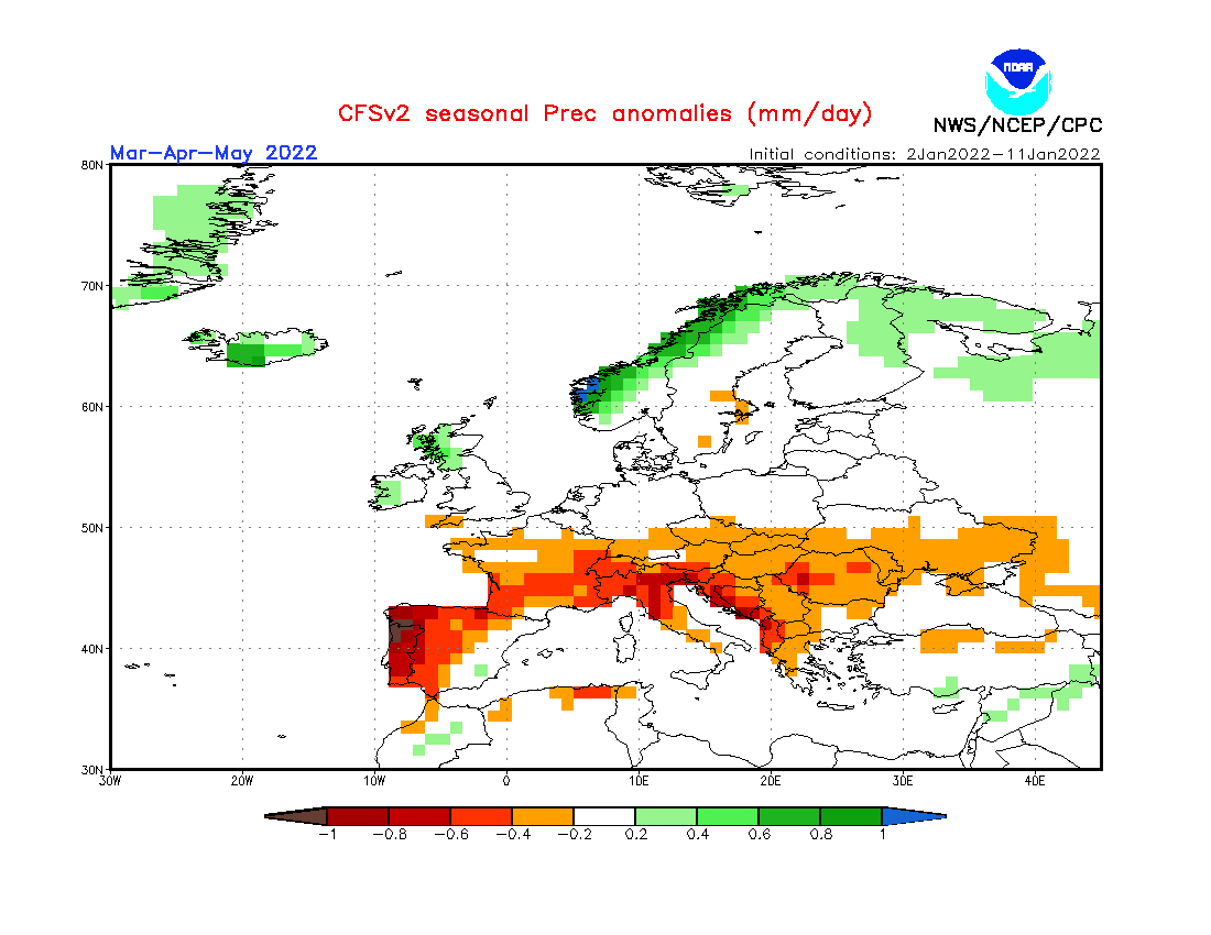
- Long-term seasonal model for precipitation for March/April/May 2022
-
- Long-term seasonal model for temperature for March/April/May 2022
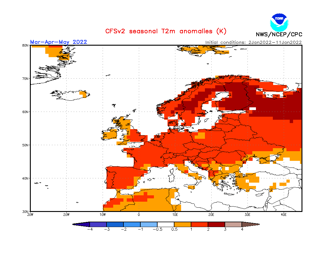
FURTHER OUTLOOK (TEMPERATURE) FOR MAR-APR-MAY 2022 – Average
FURTHER OUTLOOK (PRECIPITATION) FOR MAR-APR-MAY 2022 – Drier than Average*
* A ‘Drier than Average’ outlook means that maps are pointing towards quieter than normal storm system activity around the central Mediterranean. Whether or not a month ends up being drier or wetter than average will depend on whether any rain-producing systems that form affect land or not. This is because one or two stormy episodes may easily produce plentiful precipitation, pushing values to above average. Conversely, one or two near misses may leave the Maltese Islands land area dry, pushing values to below average.
0 comments
Write a comment