According to climate data gathered over numerous years; the mean temperature in September is of 24.6°C (a 28.1°C high and a 21.1°C low). According to climate data gathered over numerous years; total precipitation in September is of 49.9 mm.
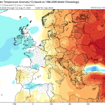
With regards to temperature, September 2020 is likely to be hotter than average. It is likely that the difference from the mean will be significant (0.75°C to 1.5°C). Despite this, no extreme heat spells are anticipated. The sea surface temperature will remain very warm. This, coupled with the southerly winds that normally characterise most days in September, will make for higher levels of relative humidity. This will make some days feel much hotter than they actually are. With regards to precipitation, September 2020 is expected to be drier than average. Maps indicate that thunderstorm activity around the central Mediterranean will have a tendency to be quieter than normal. High pressure above the Maltese Islands may cause most thunderstorms to weaken before reaching us polska-ed.com. Whether or not it ends up being significantly or marginally drier than average will depend on whether any thunderstorms that form affect land or not. Thunderstorms in September vary from extremely localised (affecting just one or two localities) to widespread (affecting the whole nation).
FURTHER OUTLOOK (TEMPERATURE)
October 2020 – Warmer than Average (+0.25°C to 0.75°C)
November 2020 – Warmer than Average (+0.25°C to 0.75°C)
December 2020 – Around Average (-0.25°C to +0.25°C)
FURTHER OUTLOOK (PRECIPITATION)*
October 2020 – Drier than Average
November 2020 – Drier than Average
December 2020 – Average
* A ‘Drier than Average’ outlook means that maps are pointing towards lower than normal thunderstorm activity around the central Mediterranean. Whether or not a month ends up being significantly or marginally drier than average will depend on whether any thunderstorms that form affect land or not.


0 comments
Write a comment