According to climate data, the mean temperature in September is of 24.6°C (a 28.3°C high and a 20.8°C low). Total precipitation in September climatically amounts to 49.9 mm. September is the first month of meteorological autumn, and as such marks the start of the gradual cooling down of air temperatures and the return of rain to our shores.
A careful study of long-term seasonal models, we’re expecting September 2021 to be overall warmer and drier (at least slightly) than the norm. Long-term seasonal models suggest that the flow of warm, stable air from the south will persist. Daytime highs are likely to continue reaching into the lower 30°C levels. Nighttime lows will remain very warm, under the influence of a very warm central Mediterranean sea. The very warm sea increases rates of evaporation from the sea, causing air temperatures to feel warmer and stickier than they actually are. The very warm sea is one of the several ingredients required for copious rainfall from autumn storms. Another essential factor are incursions of cold air from the north. These may lack, assuming the current atmospheric stability prevails. A ‘Drier than Average’ outlook means that maps are pointing towards lower than normal thunderstorm activity around the central Mediterranean. Whether or not a month ends up being significantly or marginally drier than average will depend on whether any thunderstorms that form affect land or not. This is because one or two stormy episodes may easily produce plentiful precipitation, pushing values to above average.
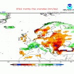
- Long-term seasonal model for precipitation in September 2021
- Long-term seasonal model for temperature in September 2021
FURTHER OUTLOOK (TEMPERATURE) FOR OCT-NOV-DEC 2021 – Warmer than Average
FURTHER OUTLOOK (PRECIPITATION) FOR OCT-NOV-DEC 2021 – Drier than Average*
* A ‘Drier than Average’ outlook means that maps are pointing towards lower than normal thunderstorm activity around the central Mediterranean. Whether or not a month ends up being significantly or marginally drier than average will depend on whether any thunderstorms that form affect land or not. This is because one or two stormy episodes may easily produce plentiful precipitation, pushing values to above average.
Disclaimer: Specific details on the weather may only be given for a couple of days in advance. This long-term forecast is not meant to determine specific weather parameters at a point on the Maltese Islands. Instead, it looks at large scale weather patterns across Europe, and attempts to determine how these may influence the weather locally. Our levels of confidence in the forecast for the month ahead are fair. These are reasonably lower when it comes to the ‘Further Outlook’ section. Weather forecasts are an interpretation of possible weather events based on trends, maps and climate data at the time of the forecast, and as a result, weather predictions may always change over time. Maltese Islands Weather can never be held responsible for any direct, indirect, incidental, consequential, special or exemplary damages or even lost profit resulting from any use or misuse of this data. The user assumes the entire risk related to the use or misuse of this data.


0 comments
Write a comment