We have received several questions on the current meteorological situation. We will do our very best to address these issues in this post.
- What is the meteorological situation like at the moment?
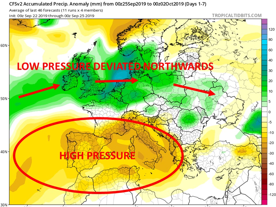
September went off to a promising start, with several localities measuring more than the average of a typical September in the first two weeks of the month. Għarb, for example, recorded 77.7 mm from 01/09 till 11/09. This abundant rainfall was the result of several thunderstorms across the central Mediterranean. These thunderstorms formed because low pressure penetrated our region. From 11/09 onward, the situation changed. An area of high pressure took over the Mediterranean region. It has persisted ever since then. This has caused the low pressure system track to deviate northwards, as shown in the below diagram.

- What are we expecting in the near future?
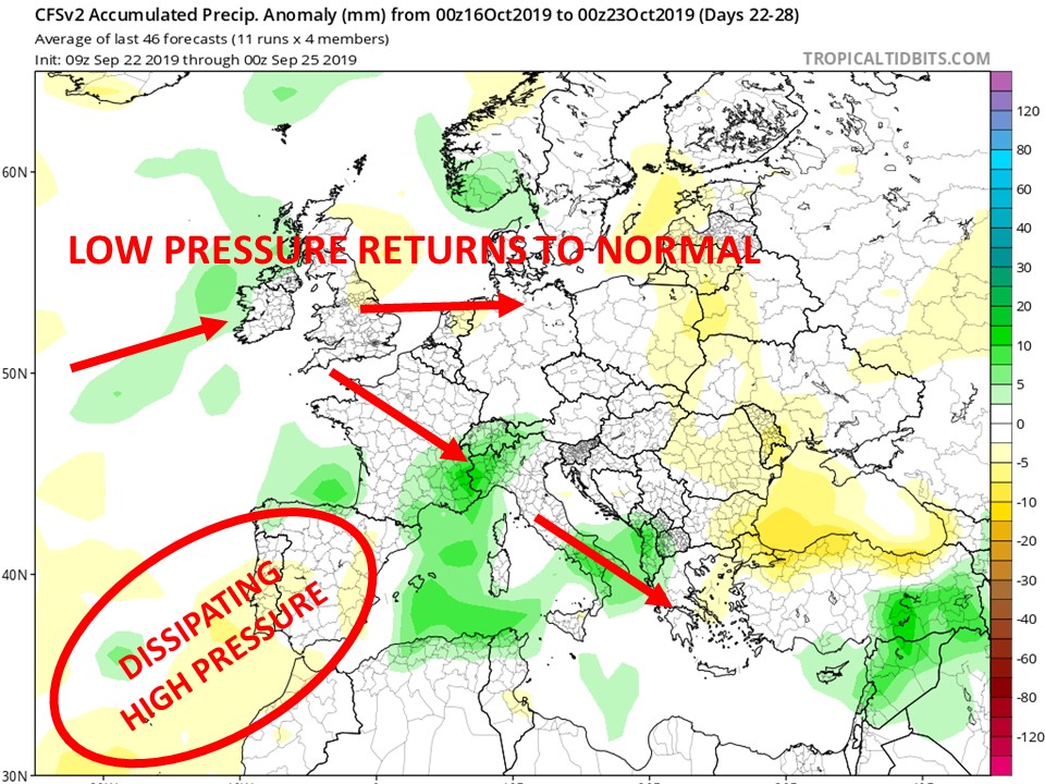
The high pressure that has taken over the Mediterranean region will prevail for now. This will continue to deviate the low pressure system track northwards. This state of affairs is expected to persist till around mid-October. This means a continuation of the drier than average weather. A day or two of rain showers is possible, but these will be few and far in between. Any showers will be isolated as well. The meteorological situation should start changing by mid-October. The high pressure that has taken over the Mediterranean will weaken gradually, allowing low pressure systems to yet again start penetrating our region, as shown in the below diagram. If this happens, we are to expect wetter than average weather in the second half of October.

- What are the implications of the warm sea around us?
The sea surface temperature is currently at 27°C. This is considered very high. It will most certainly have an impact on the weather we will experience in October. As explained, the high pressure that has taken over the Mediterranean will prevail for now. This will mean further warm temperatures and plenty of sunshine. Under the influence of high pressure, and therefore stable weather conditions, the sea surface temperature will remain warm. As long as we have no strong winds, the sea surface temperature will not fall. Once the meteorological situation starts changing by mid-October, and low pressure systems once again start penetrating our region, the very warm sea will act as fuel for these. In this case, we could expect some rain showers and thunderstorms that could be heavy at times.


0 comments
Write a comment